- IR-RABAT(VICTORIA)
- IX-XAGHRA
- ID-DWEJRA
- L-GHARB
- SAN LAWRENZ
- MARSALFORN
- IN-NADUR
- L-IMGARR
- COMINO
- QALA
- TA' KERCEM
- L-GHASRI
- IL-FONTANA
- IX-XEWKIJA
- GHAJNSIELEM
- IX-XLENDI
- IS-SANNAT
- IL-MUNXAR
Citadel/Cittadella
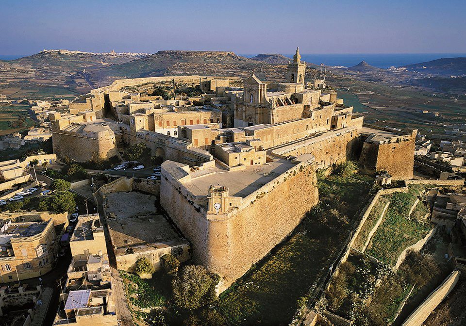 The Citadella, also known as the Citadel is a historic fortified city or castle which lies in the heart of Victoria, Gozo, Malta. The Citadella is on Malta's tentative list of future World Heritage Sites by UNESCO, who describe it as a small fortified town.
The area is known to have been first fortified during the Bronze Age c. 1500 BC. It was later developed by the Phoenicians and continued development until, by Roman times, it had become a complex Acropolis. During the Middle Ages it was known as the Gran Castello. Up until Fort Chambray was built in the 18th century it was the only fortified refuge against attack for the inhabitants of the island.
The northern side of the Citadel dates back to the period of the Crown of Aragon. The massive defensive stone walls of the fortifications which rise above the town and were built to protect the village communities from foraging corsairs attempting to take slaves and threatening invasion of Muslim forces fighting Christendom. In July 1551 an Ottoman force under Dragut attacked the Citadel, which succumbed with little resistance. The entire population of Gozo, which numbered to about 5000 to 6000 people, had taken refuge within its walls, and they were all taken as slaves except for about 300 people who managed to climb down the walls and escape. Large parts of the castle were reduced to ruins in the attack and the southern walls were rebuilt between 1599 and 1603 by the Order of Saint John.
The northern part of the Citadella now lies in ruins, while the southern section where the cathedral is located is intact. The walls have recently restored to their former glory.
Gozo Cathedral
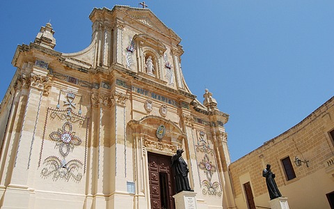 Within its walls lies a fine 17th century baroque Cathedral designed by Lorenzo Gafa, the Maltese architect who also built the Cathedral of Mdina. It is said that it lies on the site where a Roman temple dedicated to Juno once stood. It is most famous for the remarkable trompe l'oeil painting on its ceiling, which depicts the interior of a dome that was never built. There is another church dedicated to St Joseph and a chapel known as Saint Barbara within the Walls. In the latter various people are buried, including Vittorio Cassar, the son of the famous architect Girolamo Cassar.
Grain Silos & Old Gunpowder Magazine
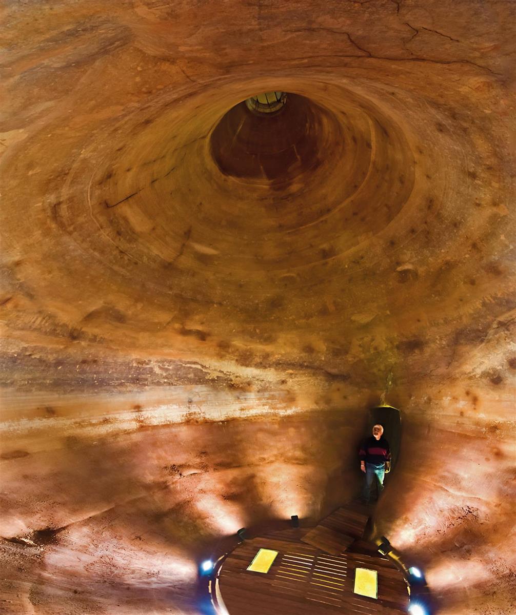 The Gozo Citadel was designed to withstand a siege and this meant having food within the fortifications. The staple diet at the time of the Knights was bread, and as part of the early-seventeenth-century refurbishments of the fortifications three large grain silos were erected on the site of the late medieval Hebrew Ghetto next to St John's Cavalier. The silos have been recently restored and can now be visited.
The grain silos are shaped like flasks and have a combined capacity of around 100 cubic metres. The largest of the three is almost 11 metres deep and measures around 3.6 meters at the widest part. During the British period (post 1800) the silos seem to have fallen into disuse and were converted into water tanks as part of a plan to better supply the growing population of the capital with clean water. In 1877, a pipeline from the Ghajn Luqin spring in ix-Xaghra was channelled across Marsalforn Valley into the former silos, providing ir-Rabat with an extra 3000 gallons of fresh water in winter and 600 gallons in summer. The spacious rock-hewn room that now leads into the silos and the passage that links the three silos together, date from this time. Also, an impermeable layer of lime-based sealant was applied throughout to keep the water within the porous rock.
This specialist storehouse next to St John's Cavalier in the Gozo Citadel was where the gunpowder was stored for the Citadel's guns in the late seventeenth and eighteenth centuries. In the age of gunpowder older fortifications had to be adapted to cope with heavy guns. At the turn of the eighteenth century, Gozo's Citadel was armed with between thirty and forty artillery pieces, several mortars and close to four hundred muskets. Needless to say, the effectiveness of these weapons relied on a ready supply of good quality gunpowder. This had to be stored somewhere that was both accessible and protected from enemy fire. This gunpowder magazine was added to an early seventeenth century rampart probably shortly before 1690. It would have been accessible from today's Triq Bieb l-Imdina yet hidden from enemy view, and beyond the reach of most of the enemy's guns.
www.wirtghawdex.org
Old Prison
The Old Prison is situated in the Citadel of Victoria, Gozo, adjacent to the Courts of Justice, to which it was originally connected. Now the prison complex appears divided into two different buildings: the entrance hall, which had been a common cell in the 19th century and a free-standing block with six individual cells. This prison was in use from the mid-16th century until 1962. First it used to host the roudest or most riotus knights to cool down therein, even the most historical one, Fra Jean Parisot de La Valette, later Grand Master of Malta, was imprisoned there in 1538. The site is well preserved in its original state, and one can find there a large amount of graffiti etched into the limestone walls. Representations are often of ships, hand-prints, crosses, names, dates, games, and anthropomorphic figures.
www.heritagemalta.orgMuseum of Archaelogy
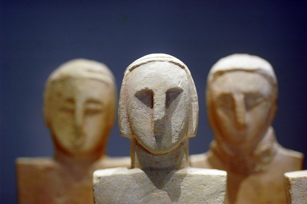 The Gozo Museum of Archaeology illustrates the cultural history of Gozo from prehistoric times to the early modern period. It relies on themes like burial, religion, art, food and daily life, making use of material from various archaeological sites in Gozo.
The Museum is located immediately behind the original gateway to the Citadel and is housed in a 17th century townhouse which was once the residence of the Bondi family. Subsequently, it fell into disuse and remained long neglected until Sir Harry Luke, Lieutenant Governor of the Maltese Islands, took the initiative to restore it in 1937. In May 1960, Casa Bondi was inaugurated as the first publicmuseum of Gozo hosting artefacts of archaeological and of ethnographic nature. The building came to house the archaeological collection in 1986 as part of a reorganisation programme of the Gozo museum collection into separate collections housed in separate buildings in the Citadel.
Folklore Museum
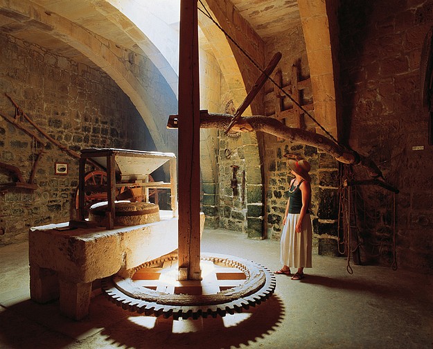 The Folklore Museum is housed in a cluster of medieval houses in Bernardo DeOpuo Street in the Citadel in Victoria, Gozo. It hosts a wide range of exhibits illustrating the local domestic, rural and traditional ways of life.
The interconnected houses hosting the museum, were probably built around the early 16th century. The architectural features betray some Sicilian and Catalan influences and show knowledge of a sophisticated Late Gothic style. Certainly, the houses belonged to wealthy families, as evidenced by the fine architectural features on the facade. These houses were rehabilitated as a Folklore Museum in 1983.
The exhibits on the ground floor relate to rural trades and skills like agriculture and stone-masonry. Here, one finds various traditional implements used in agriculture along with a varied selection of grinding mills. One substantial example occupies the centre of a large reconstructed mill-room. One also finds a large selection of tools used by carpenters and blacksmiths. The same ground floor display also includes grain and liquid measures and various types of weights and scales. The display on the mezzanine level has a section devoted to such hobbies like the modelling of miniature churches, replete with religious accessories. An interesting ex-voto collection is another highlight which portrays bygone pious traditions. The first floor, once the living quarters of the resident wealthy families, hosts an exhibition of items related to important local crafts such as lace-making and weaving and these are complemented by items related to the cotton industry like the cotton gin and the spinning wheel. Another small part of the first floor collection is devoted to the traditional fishing industry.
The traditional way of life of the local population is brought back to life with this array of material representations presented for public viewing in this museum.
www.heritagemalta.org
St George Basilica
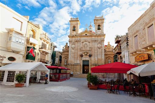 St George's Basilica is situated in the middle of Victoria, the ancient "Hagar" - the capital of Gozo, the second largest island in the Maltese archipelago, and is surrounded by a maze of old narrow streets and alleys. Today's basilica was built between 1672 and 1678.
The liturgical feast of St George Martyr,falls on 23 April, but external festivities are celebrated with great pomp in the city during the week leading to the third Sunday of July.
Heart of Gozo - Il-Hagar Museum
 It is an audio-visual, fine arts and historical museum that tells a story. It is unique in the Maltese islands in that its construction, including a medieval wing, was conceived and designed as a modern multi-mediatic museum that includes audio-visual halls and interactive points on every floor.
The museum is an innovative element, aiding in the branding of the islands of Malta and Gozo as cultural destinations of excellence.
www.heartofgozo.org.mt
Aqueducts
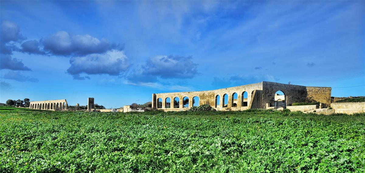 The Aqueducts, which can be seen on the left hand side of the road between ir-Rabat and Ta' Pinu, were built under the British between 1839 and 1843.
The Aqueducts' purpose was to supply the population with fresh water, bringing it from Ghar Ilma (Cave of Water) hill to the central water reservoir within the ir-Rabat (Victoria) Citadel. An Obelisk erected to celebrate the arrival of the first water from Ghar Ilma still stands on the spot of the first water reservoir half way up ir-Rabat (Victoria)'s Castle Hill leading to the Citadel.
St Francis Church
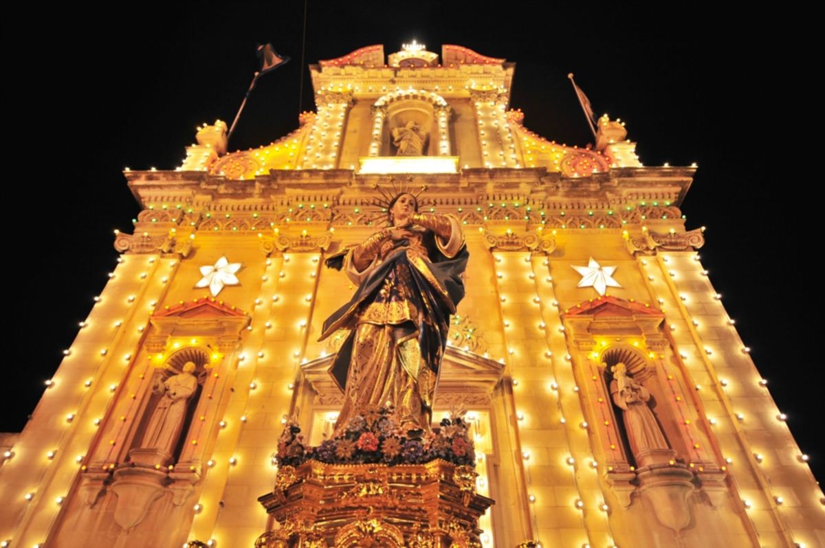 The Friary of Saint Francis was established at the outskirts of Victoria by Father Jacob de Leo, Provincial Minister of the Sicilian Province in 1492. The friars were then entrusted with the Chapel of St Mark in "contrada San Giacomo" by the bishop of Malta Monsignor Paolo de la Cavaleria. A cemetery for noble people existed in front of the same chapel and a cross made of stone marked the boundary of the said cemetery. The friars dwelt in some big caves that existed along the falls of the compound. In 1535 the titular of the chapel was changed to that of Saint Francis. A wooden statue of Saint Isidore which dates back to 1680 still exists today. This was originally gilded in gold but it was painted over in order not to attract the attentions of the invading French. In 1663 a Confraternity of the Immaculate Conception of Our Lady was founded in the church to help in the organization of the feast and in 1698 a wooden
statue of Our Lady representing the Immaculate Conception was used in a procession. The feast is still celebrated on the 8th of December.
Villa Rundle Garden
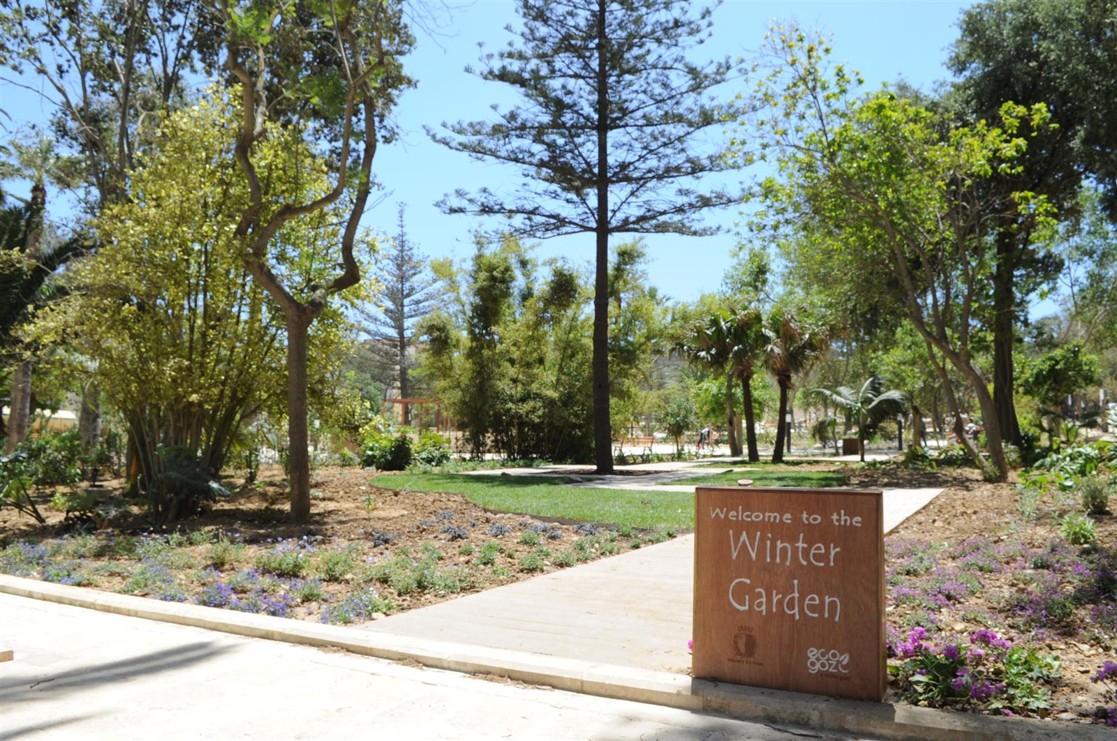 The beautiful Villa Rundle Public Gardens is located in Victoria, Gozo, in the lower part of Republic Street. The gardens were planted by and named after the British General Leslie Rundle around 1915 and have been renovated recently. Due to Villa Rundle Garden's perfect location in central Victoria, it is a perfect resting place for many shoppers and for people who just want sit back enjoy the green surroundings away from the hustle and bustle of the busy town.
Ramla Bay
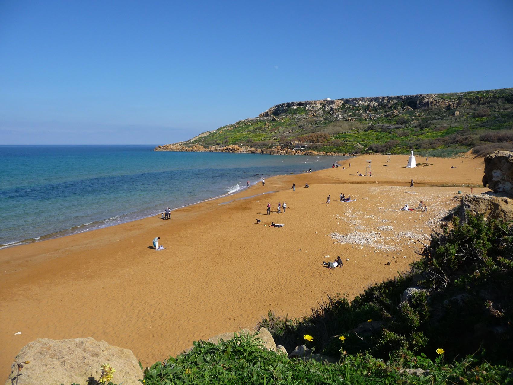 Ramla Bay is located at the bottom of a rich and fertile valley on the northern side of the island of Gozo. The village of Xaghra, located on one of the hills of Gozo, overlooks this valley. Bus service to the beach is very regular. The terraced walls built by the farmers give the valley an appearance of a quilt when viewed from the high ridges surrounding it.
The beach is quite wide and sandy. It is a particularly golden-reddish sand which makes this beach different from all others in Gozo and Malta. Its real Maltese name is Ir-Ramla l-Hamra - the Red Sandy Beach. The area around the beach is quite interesting and provides some very rich historical treasures. Roman remains lie beneath the sand and the famous Calypso Cave overlooks the western side of the beach.
The beach is popular with both Maltese residents and tourists, and part of it is a Natura 2000 site. There are two cantinas on the beach and several ice cream kiosks. The beach is surrounded by hillsides on both the west and east where many local farmers have gardens and orchards. A sandy path on the eastern hillside leads up to the Calypso Cave.
Roman Domus
At the west end of the popular Ramla beach below ix-Xaghra, an extensive Roman villa was revealed in 1912. One wall can still be made out. A full plan is displayed in the Gozo Museum of Archaeology. In the 18th century, a redoubt was built over it. In addition, a wall was erected below water level across the bay to impede any invading force, and rocks at either end were drilled to serve as cannon. That on the east is still visible.
Calypso Cave
According to tradition, this is the cave referred to by Homer in The Odyssey. The nymph Calypso lived in this cave and it is where she entertained Ulysses for seven years before he resumed his journey. Calypso Cave is in fact a series of caves and, according to some, these extend right down to the sea. Recently the cave has been closed to visitors since there are some parts of it which are dangerous.
Ggantija Temples
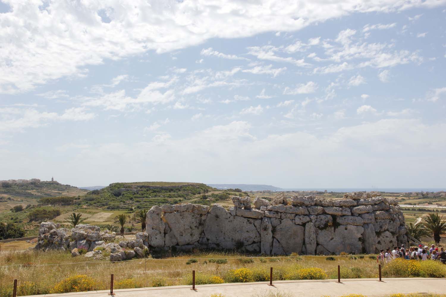 Ggantija ("Giants' Tower") is a Neolithic, megalithic temple complex on the Mediterranean island of Gozo. The Ggantija temples are the earliest of a series of megalithic temples in Malta. The Ggantija temples are older than the pyramids of Egypt. Their makers erected the two Ggantija temples during the Neolithic Age (c. 3600-2500 BC), which makes these temples more than 5500 years old and the world's second oldest manmade religious structures, after Gobekli Tepe. Together with other similar structures, these have been designated a UNESCO World Heritage Site, the Megalithic Temples of Malta.
The temples were possibly the site of a Fertility cult; archeologists believe that the numerous figurines and statues found on site are connected with that cult. The temples have exercised many a mathematical and engineering mind, seeking a solution to the mystery of how these huge stones were quarried, transported and then lifted upright in those primitive times. According to local Gozitan folklore, a giantess who ate nothing but broad beans and honey bore a child from a man of the common people. With the child hanging from her shoulder, built these temples and used them as places of worship. However it was stone balls, which one can see strewn around the site, which probably served as rollers to transport these huge blocks of stone to the site.
Entrance to the Ggantija Temples is from a newly constructed Interpretation Centre that provides visitors with the opportunity to explore various aspects related to life in the Neolithic. The centre is also home to a selection of the most significant finds discovered at various prehistoric sites in Gozo. The Centre is linked to the temple site via an external pathway that provides visitors with unique views of the natural landscape that surrounds Ggantija.
The site consists of two temples, contained within a single outer wall. Although sharing a common fašade, each temple unit has a separate entrance. The south temple has a five apse plan and is the older of the two, as well a being the larger and better preserved. The left apse in the second pair of apses, has three niches complete with capstones. Some suggest it might refer to a triple divinity, a triade. The remains of a fire-reddened circular stone hearth, possibly for an eternal flame, is in the opposite apse, where there are also remains of what was probably a small enclosure where oracles were delivered. The north temple is considerably smaller, but with a more evolved four-apse plan having its rear apse replaced by a shallow niche. The entrance is very similar to that of the first temple; only the threshold is narrower and shorter.
www.heritagemalta.org
Xaghra Parish Church
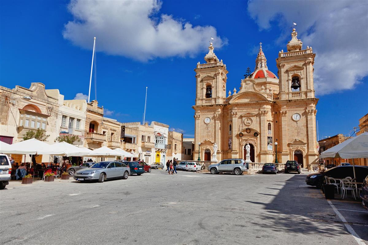 Xaghra Parish is dedicated to Our Lady of Victories, locally known as 'il-Bambina'. The liturgical feast is celebrated on the 8th day of September each year and is a crowd puller as it as the last feast in the summer festa season.
Ninu's Cave & Xerri's Grotto
 Xerri's Grotto (pronounced sherry) is an underground cave in the village of Xaghra, Gozo, Malta. It was discovered in 1924 underneath a house during digging for a well. Tours are given by the owners of the house. Xerri's Grotto is not far from another underground feature, Ninu's Cave.
Xaghra Stone Circle
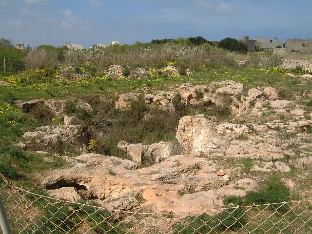 The Xaghra Stone Circle, also known as the Brochdorff Circle since there may be two Circles at Xaghra, is an underground funerary complex, situated in Xaghra on the Maltese island of Gozo. It was first discovered by John Otto Bayer in the 1820s and rediscovered in 1964 after Gozitan researcher Joe Attard Tabone examined a painting by Charles Brochdorff in the National Library in Valletta.
It was excavated by a joint team from the University of Malta, the Maltese Museums Department and the University of Cambridge. The excavation uncovered the burial ground of the same community which practised its rituals in the nearby Ggantija temple, dating principally to the period from 3000 to 2400 BC. The most notable discoveries include more than 200,000 human body parts and prehistoric art relating to the builders of the prehistoric Maltese temples
An earlier chambered tomb on the site dates to the period between 4100 and 3800 BC.
Later occupation of the site in later third millennium appears to be domestic.
Santa Verna Temple
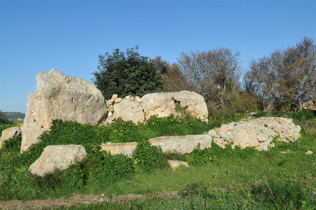 This ruinous monument is of a temple on Gozo which probably rivalled in importance those of the major temples, Ggantija, Tarxien and Hagar Qim.
The site was first excavated in 1911 when all that was found were the surviving group of 3 uprights, the tallest being over 7' high, 3 horizontal blocks lining the eastern side of the uprights, and a beaten earth floor from which it was possible to make out a typical trefoil or 3-apse temple design.
Ta' Kola Windmill
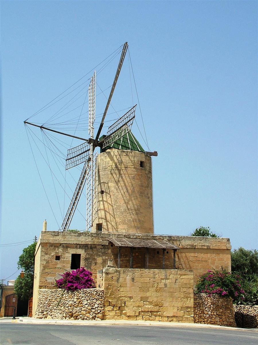 Ta' Kola Windmill in Xaghra, Gozo, is one of the few surviving windmills on the Maltese Islands dating back to the Knights' Period. Its origins go back to 1725 during the magistracy of Grand Master Manoel de Vilhena (1722-36). As its construction seems to have incorporated bad quality stones and mortar, it had to be dismantled and reconstructed during the 1780s.
The windmill's name Ta' Kola is connected with the last miller, Guzeppi Grech who was popularly known as Zeppu ta' Kola (Joseph the son of Nikola).
Apart from operating the windmill, the miller would likely have performed several secondary jobs to keep himself employed when weather conditions made it impossible to operate the mill. When the wind was favourable for the mill to be operated, the miller would let the locals know by blowing through a triton-shell (Maltese bronja) and villagers would then bring their cereals to be ground into flour.
Its construction follows a plan which is echoed in most Maltese windmills of the period and consists of a number of rooms on two floors surrounding the centrally-placed cylindrical stone tower. The latter houses the milling mechanism which consists of two circular hard-wearing stones placed on top of each other to crush the grain forced between the two rotating surfaces. On the ground floor of the windmill one can observe the workshop premises containing a vast array of tools, some of which were originally manufactured by the owners of the mill. On the first floor, the living quarters of the miller including the kitchen, dining room and bedrooms, have been recreated using traditional furniture and items related to Gozitan crafts. In the kitchen one may find traditional utensils and cooking ware which are today hard to come across.
www.heritagemalta.org
Pomskizillious Museum of Toys
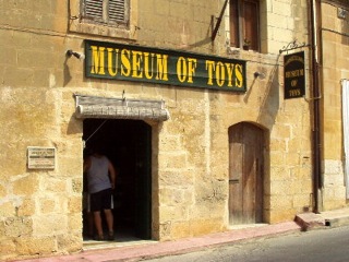 The Pomskizillious Museum of Toys in Gozo is a curious and delightful privately owned collection. Edwin and Susan Lowe, a British couple from Devon, assembled a fine assortment of genuine nineteenth and twentieth century toys. The three hundred year old converted farmhouse in which the toy museum is located provides an ideal home to this unique collection.
These outstanding antiques have found their home in Gozo from various parts of the world but the best represented countries are the usual suspects when it comes to the main Western European toy manufacturing regions of the period...this includes England, France, Germany and Italy. International renowned brands such as Steiff, Lenci and Kathe Kruse soft toys, Schuco & Lehmann clockwork tin toys and a Wedgewood tea set may be found here.
The Pomskizillious Museum of Toys has a vast repertoire, from an authentic Maltese doll that has survived for over two centuries to more 'modern' train sets from the dirty thirties.
In-Nuffara
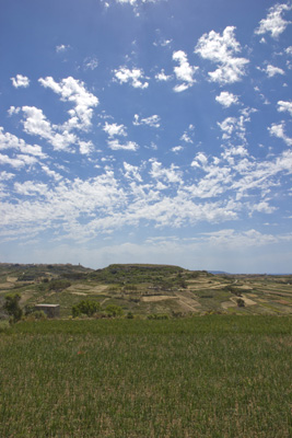 An isolated plateau between Ggantija and in-Nadur once supported a large village of the Borg in-Nadur phase (circa 1500-700 BC). Its huts have all been swept away by weather and agriculture, but a number of grain storage pits can still be seen, one of which was cleared in 1961, producing large numbers of sherds of that phase. Other Bronze Age sherds are common across the whole plateau.
Azure Window
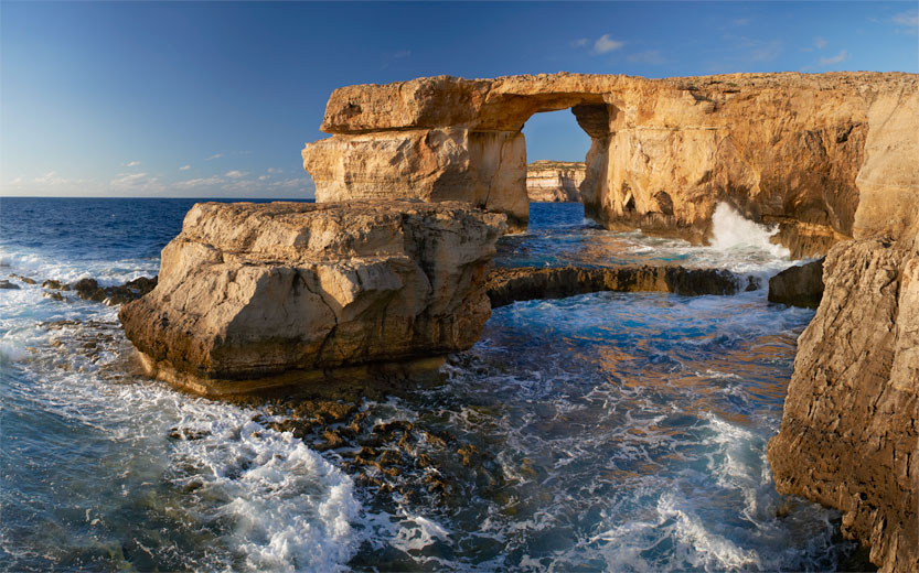 The Azure Window is a Limestone natural arch on the Maltese island of Gozo. It is situated near Dwejra Bay on the Inland Sea. The formation, which was created after two limestone sea caves collapsed, is popular with scuba divers.
Dwejra Tower
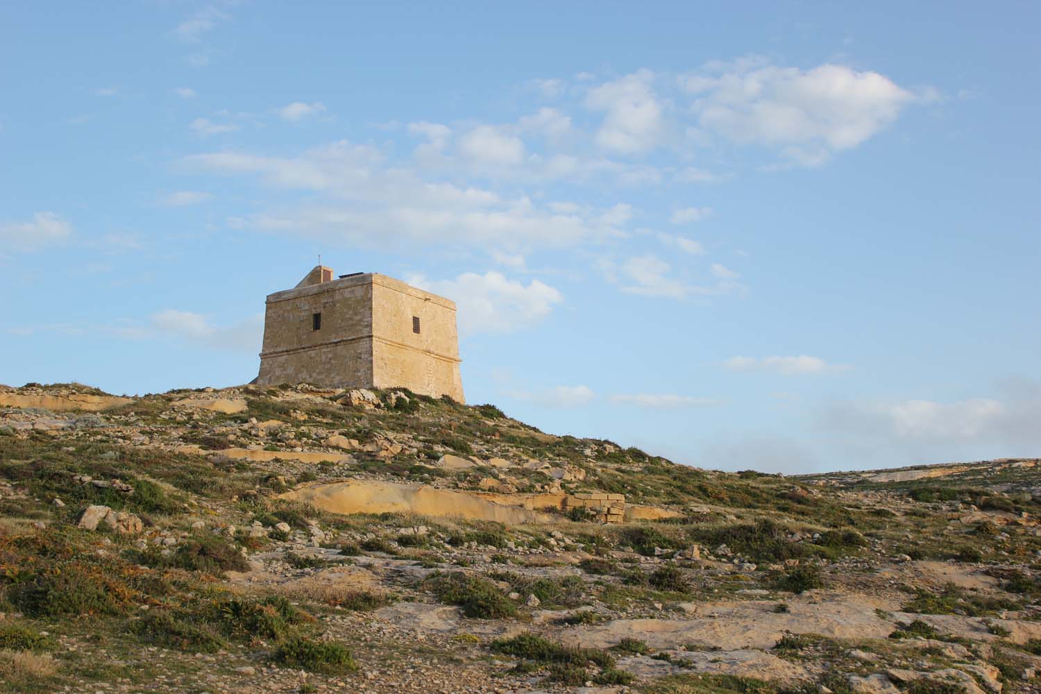 Dwejra Tower was built in 1652 during the reign of Grand Master Lascaris to guard the previously undefended Dwejra coast. The Tower was also used to deny access to Fungus Rock (also known as "Il-Gebla tal-General" - General's Rock) preventing anyone not authorised by the Order of St John from collecting the famous "fungus melitensis" (Maltese Fungus) - erroneously believed to have unique medicinal properties. So precious was the 'fungus' at that time that in 1744 the Grandmaster had the Rock's perimeter scraped smooth to make unauthorised climbing more difficult. Anyone caught stealing the plant, was punished by death or rowing the Order's galleys for life!
The Dwejra Tower was armed with three 6-pounder cannons and two swivel guns (Spingardi). The Capo Mastro (Detachment Commander) was a Bombardier and was assisted by an Aggiuntante, while three more armed men provided a constant guard at night. Although additional trenches, redoubts and defensive mounds were later added to consolidate the defence of the extensive Dwejra coastline, only the Dwejra Tower survives.
The tower remained in use until 1873, after which it fell into disrepair, until its restoration in 1999 by Din l-Art Helwa (Malta's National Trust).
Inland Sea
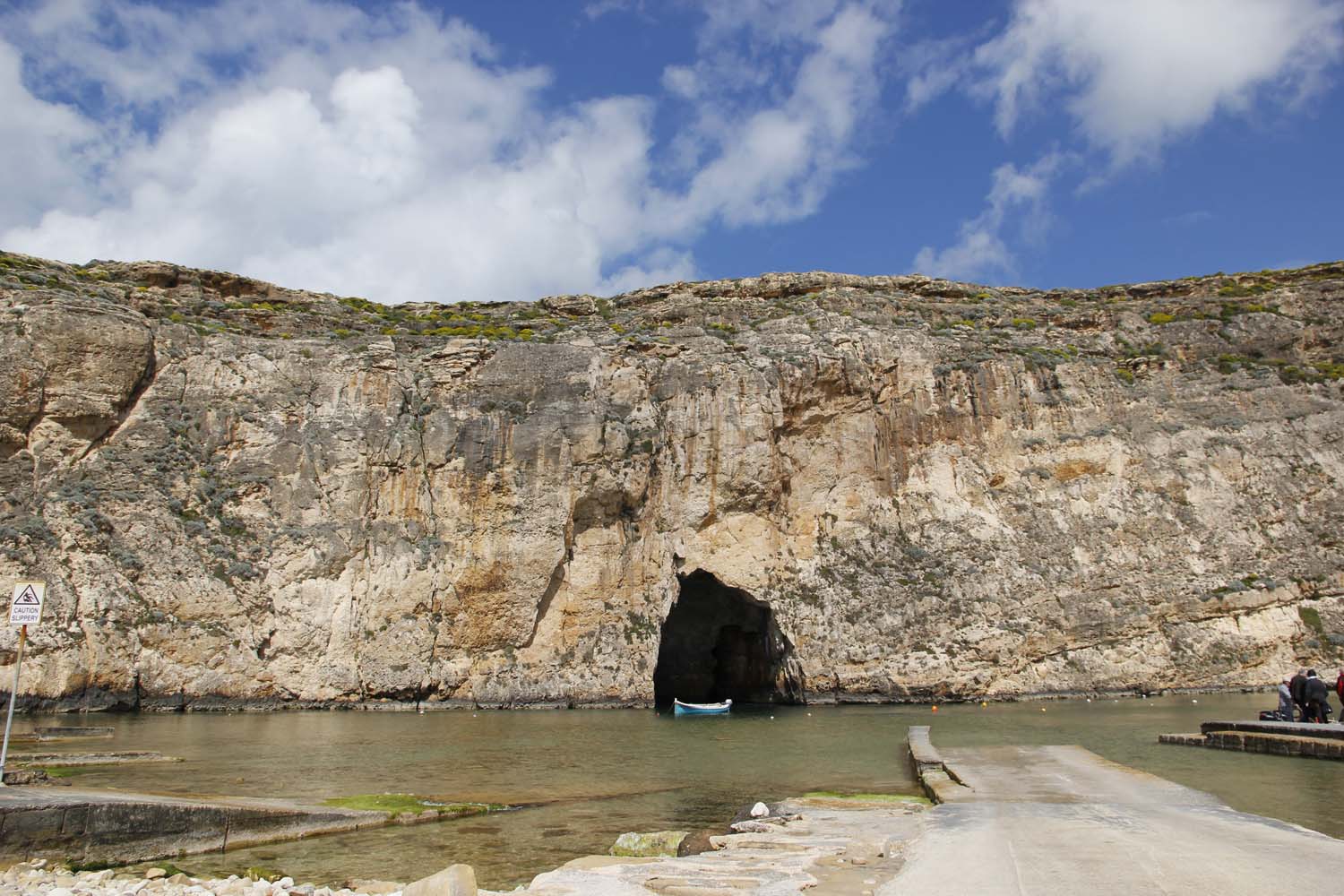 The Inland Sea, sometimes called Qawra in Maltese, is a lagoon of seawater on the island of Gozo linked to the Mediterranean Sea through an opening formed by a narrow natural arch.
It was probably formed where a geological fault in the limestone had created a sea cave and the roof then collapsed.
On one side there is a gently shelving stony beach with several fishermen's huts. The boats are often pulled up on to the stony beach. The bottom of the lagoon is also mostly pebbles and rocks and is fairly shallow. As you exit through the tunnel towards open sea, the floor drops away in a series of shelves to a depth of up to 35 metres on the outside. Jacques Cousteau said the Inland Sea was among his top ten dives. On calm days fishing boats, known in Maltese as luzzijiet, can pass through the tunnel. Some of the boats are used to take visitors through the archway and then for a tour of the nearby cliffs and other sites, mainly to the Fungus Rock and another large natural arch in the cliffs called the Azure Window.
Cart Ruts
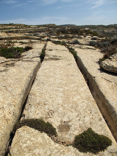 Gozo has four good sets of the mysterious cart-ruts, and a few minor ones. At Tan-Nemes, well east of il-Qala, a pair runs out onto a spur overlooking the Fliegu ta' Ghawdex. At Ta' Tingi, several fine pairs can be found in the olive grove west of the pumping station, just south of ix-Xewkija. An extensive system covers the Ta' Cenc plateau, best seen between the hotel and the cliffs, and running near, but not to, Borg l-Imramma. They continue for nearly a kilometre to the east. An impressive pair zigzags down the slope from the San Lawrenz quarries to end on the cliffs above the Azure Window at Dwejra.
Gharb Folklore Museum
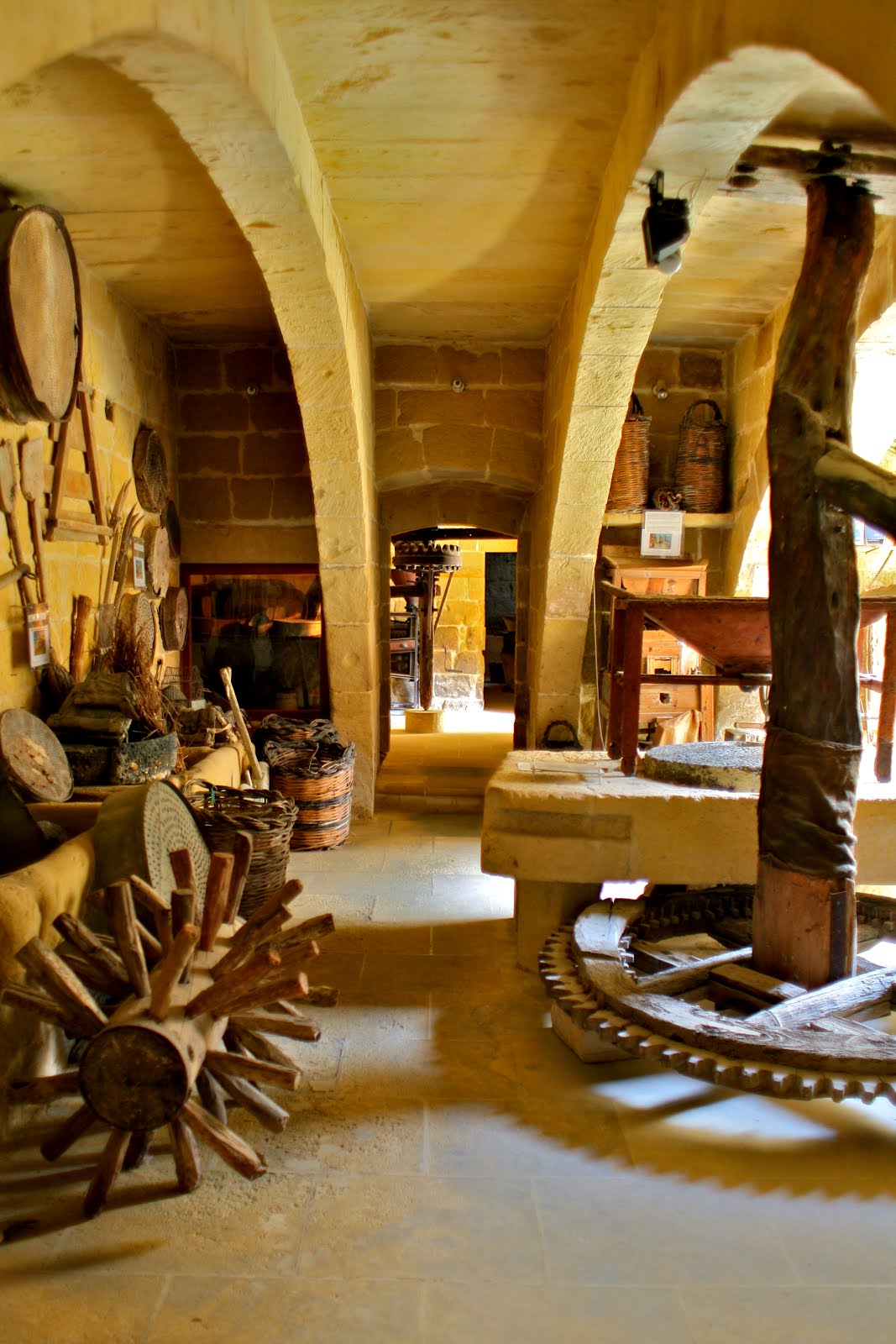 The privately-owned l-Gharb Folklore Museum is a unique early-18th-century village house with 28 rooms full of historic objects associated with Gozo's tradtional trades, crafts and passtimes. From milling to printing, carpentry to wine-making, fishing to smithing, the museum offers an insight into Gozo's traditions and a glimpse of everyday life in the distant and not-so-distant past.
Wied il-Mielah
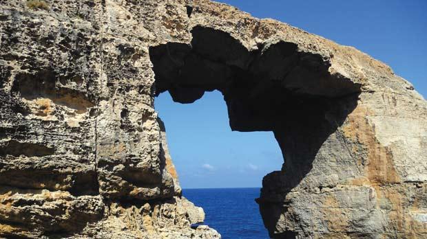 The valley of Wied il-Mielah is rich in flora and a lovely place to walk especially in the autumn and spring. The way down the valley is like a botanical display of vegetation typical of the Mediterranean. Yellow rather than green is the primary colour here especially from late autumn until spring, when many fields bloom with the small yellow flower of the Cape Sorrel.
This valley leads to into Gozo's second geological 'window'. The Wied il-Mielah Window is located at the end of the Wied il-Mielah Valley and is in contrast to the Azure Window, which is located on the west coast of Gozo, rather unknown.
Ta' Pinu
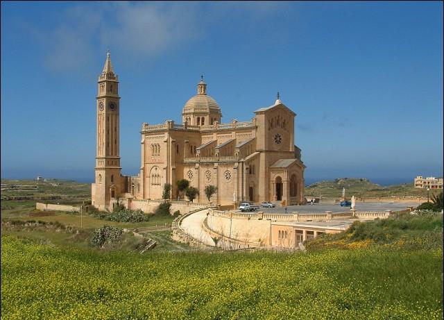 The National Shrine of the Blessed Virgin of Ta' Pinu (Maltese: Santwarju tal-Madonna ta' Pinu) is a Roman Catholic minor basilica and national shrine located some 700 metres (2,300 ft) from the village of Gharb on the island of Gozo, the sister island of Malta. The church is dedicated to the Blessed Virgin of Ta' Pinu. The basilica is located on the edge of a cliff in open countryside which allows visitors to enjoy beautiful views of the area.
In 1883, Karmni Grima was walking past the now run down church and heard a voice asking her to recite three Hail Marys'. Over the following years miracles were attributed to the grace of Our Lady of The Assumption to whom the church was dedicated. The works for the new church began on 30 May 1922, to be consecrated on 31 August 1932. It was built in a neo-romantic style. Inside the church there are 6 mosaics, 76 coloured windows and many ex-voto. The bell tower is 61 metres high. Pope John Paul II celebrated mass on the parvise of the shrine during his visit to the island of Gozo on 26 May 1990. On 18 April 2010, when visiting Malta, Pope Benedict XVI donated and placed a Golden Rose in front of the devotional image of Our Lady Of Ta' Pinu which was brought over from Gozo to Malta for this special occasion. The Pope invited everybody to "Pray to Her Under the Title Queen of the Family"
San Dimitri
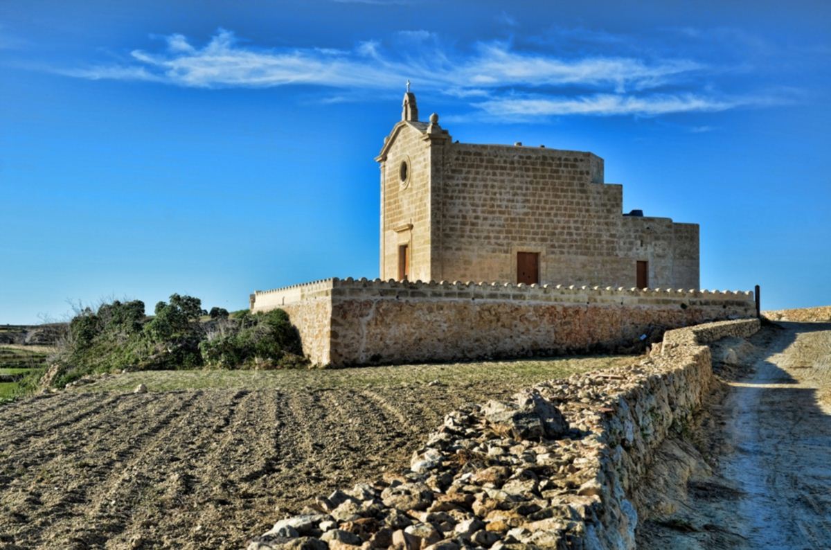 This chapel full of myth and legend is built on a promontory just outside the village of Gharb, close to a cliff called Ras San Mitri (The Cape of St. Demetrius). Approached by a country road from Gharb, the chapel stands in a delightful spot and is Gozo's westernmost chapel.
An early fifteenth century chapel was rebuilt in 1736 to create the building we see today. The altarpiece above the stone altar shows St. Demetrius on horseback with an old woman praying and a young man in chains. This relates to one of several legends about the chapel.
This legend - a favourite of historians and poets alike - tells how an old woman called Natalizja Cauchi, nicknamed Zgugina, was at home one night with her son Matthew when Barbary corsairs swooped on the island, broke into Zgugina's house, knocked her down and made away with her son. The unfortunate woman ran weeping to St. Demetrius' chapel and poured out her heart in passionate prayer, saying: "San Dimitri, bring me back my son, and I'll light your lamp with a measure of oil." St. Demetrius heard her supplication. She saw him moving in the painting, whence he rode out in pursuit of the Turkish galley. Soon he was back holding the boy in his arms. He re-entered the picture, but a mark from his horse's hoof remained imprinted on the rock. The grateful Zgugina kept a lamp lit to the saint day and night. A coda to this legend has it that during an earthquake the rock on which this first chapel was built, broke off and fell into the sea but the chapel did not break up. Sailors and fishermen have often reported seeing light in the depths of the sea - Zgugina's lamp still burning under the water! Another version of this tale tells of a ship that dropped anchor close by. The anchor stuck and could not be recovered so a sailor dived overboard to try to pry it loose. When he did not resurface, another sailor went to look for him. After a while both sailors surfaced and recounted to the awed crew how on the sea floor they had seen the chapel with the lamp in front of the painting still alight.
Ecclesia Mater - Parish Museum
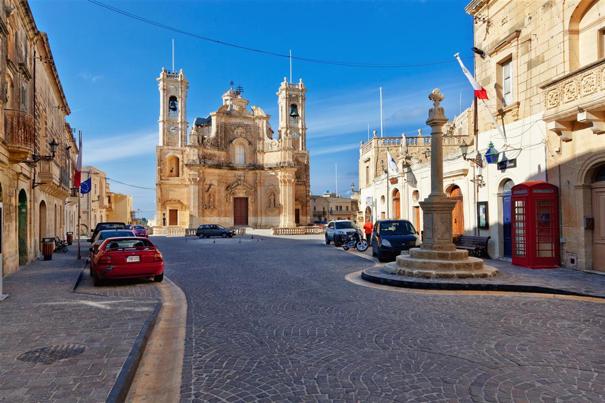 Ecclestia Mater - Parish Museum, is the name given to the parish museum that has been set-up at the Gharb Collegiate and Basilica complex and houses a permanent exhibition of Sacred Art.
The museum hosts an exhibition of sacred arts that reflects the old roots of the community of the Gharb together with the Reverend Chapter courtroom which has been recently renovated.
Craft's Village
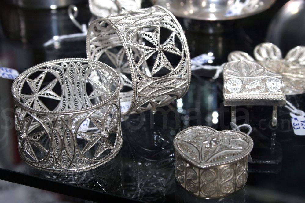 This craft village is very well laid out with individual shops scattered around the site. When visiting the Ta' Dbiegi Craft Village in Gozo you can see hand-made pottery, Gozo lace, glass blowing and leather items all being made in the crafts village. You can see a fascinating demonstration on how lace is done, something that should not to be missed. Visiting the Ta' Dbiegi Craft Village in Gozo gives you the unique opportunity to buy handmade lace and other items which are perfect souvenirs and gifts to bring back home to family and friends.
Marsalforn Bay
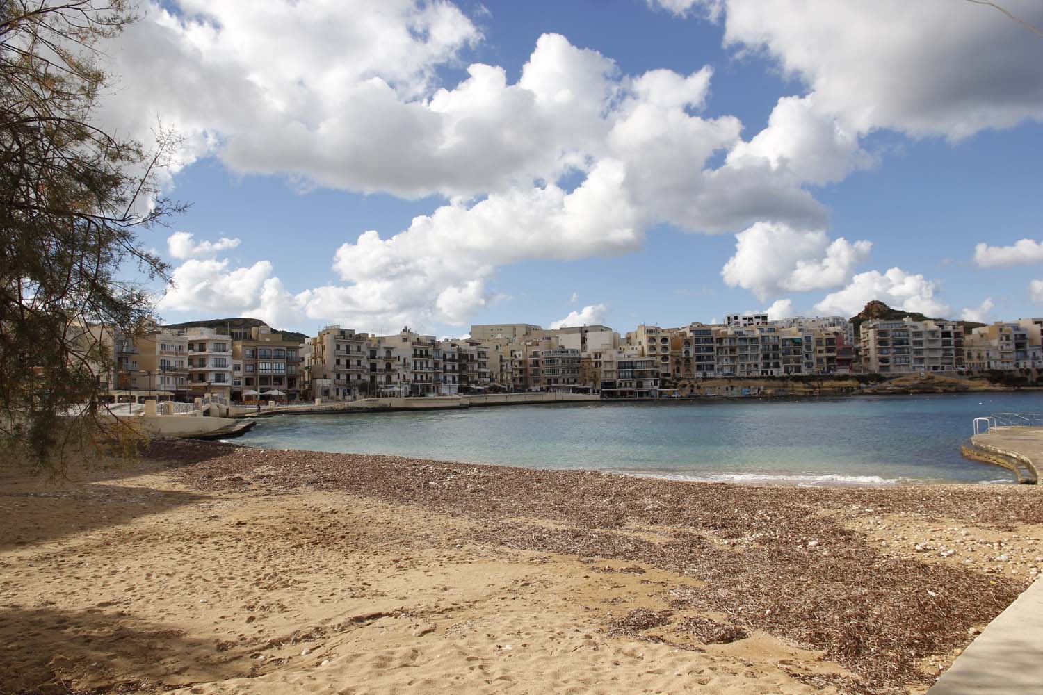 Marsalforn is the most popular resort on the Island. In summer it throbs with life as hundreds of Gozitan and Maltese families move in to spend the summer at the coast and foreign visitors arrive for a revitalising dose of sun and sea.
A beach of sand and small pebbles is backed by a promenade which runs right round the head of the bay, providing a pleasant place to stroll at all times of year and a traditional summer evening gathering place for local families and visitors alike.
Qolla l-Bajda Battery
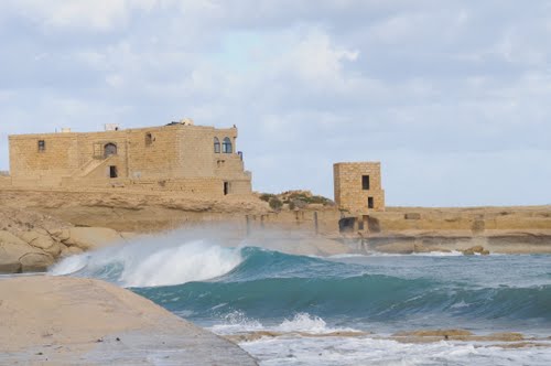 Qolla il-Bajda Battery overlooking the inlets of Qbajjar and Xwejni was built between 1715 and 1716. The battery, with its semi-circular platform, was protected by a ditch on its seaward side. The gorge of the battery was defended by two blockhouses which were joined together by a wall. Musket loopholes in the short flanks of the blockhouses enabled the defenders to provide protective gunfire along the battery's land front. The main gate leading into the battery was approached by a short flight of steps across a drawbridge. The battery's armament in 1770 was four 6-pdr. guns with 276 rounds of roundshot and 60 rounds of grapeshot.
Saltpans
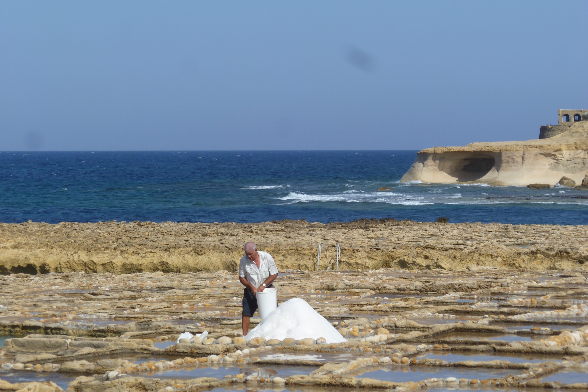 On the north coast of Gozo, just past Qbajjar Bay west of Marsalforn, the coast is characterised by a chequerboard of rock-cut saltpans protruding into the sea. These 350-year-old salt pans, which stretch about 3km along the coast, are more than just scenic. They are part of the centuries-old Gozitan tradition of Sea-Salt production that has been passed down within certain families for many generations. During the summer months, locals can still be seen scraping up the crystals of salt. Once collected, the salt is stored and processed in the caves that have been carved into the coastal rock.
Ix-Xwejni & Qbajjar Bay
 Ix-Xwejni (Xwejni Bay) and il-Qbajjar (Qbajjar Bay), both easily reached through Marsalforn or iz-Zebbug, are two shallow bays right next to each other, with small pebble beaches and rocky stretches leading into clear blue water. There is excellent swimming here enjoyed by locals and visitors alike and this is also a popular place for diving, especially for beginners. A few fishing boats are based here too and there are a couple of bars and restaurants on the sea front.
Ghajn Barrani
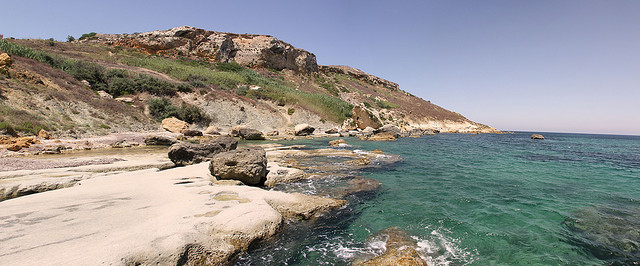 Ghajn Barrani is the stretch of cliffs from Marsalforn to the sandy beach of Ramla along Gozo s north coast. The area is characterised by flat terrain and clay slopes rich in flora. Anyone interested in plants should make their way here for a beautiful coastal country walk. Ghajn Barrani (reached through Marsalforn and Xaghra) is not easily accessible and some scrambling over rocks is necessary to reach this tiny, quiet and secluded sandy beach.
Tas-Salvatur Hill
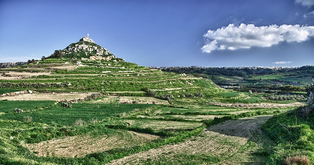 This hill can be seen from much of Gozo, topped with a statue of the Risen Christ. This statue was placed here in the 1970s and sits 320-foot on the top of Tal-Merzuq Hill (now popularly know as Tas-Salvator - The Redeemer). This is a place of popular religious myth and legend.
According to tradition, black smoke was once been seen coming out of the hill and this led to the belief that it was a volcano. Some still believe this although geologists dismiss the idea as nonsense.
A statue of Christ was first put on the hill in 1904 when Gozo was consecrated to Jesus the Redeemer (leading to the popular name Tas-Salvatur) . It replaced a wooden cross that had been erected even earlier. The first statue of Christ was not resistant to the elements, however, and had to be replaced in the 1960s. The second statue was also destroyed - this time when its supporting pedestal gave way during a thunderstorm. Parts of this statue can still be seen strewn around the hilltop.
Ta' Kenuna Tower
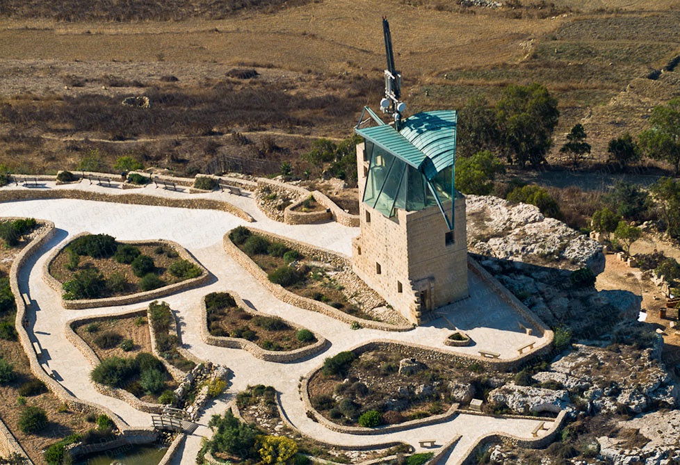 Ta' Kenuna Tower is one of three semaphore towers built by the British in 1848 on the cliffs near Nadur in Gozo, Malta.
Sited on a hill 130 metres above sea level, its purpose was to pass on signals to ships and other posts via a telegraphy link between the two main Maltese islands. In 2005 the Nadur Local Council with the help of Maltacom (now GO) sponsored restoration works of the tower. A beacon to warn ships of their proximity to land, as well as a number of communication antennas were installed on the roof.
Today, one can ask permission from the tower's watchman to go on top of the covered roof of the tower for a panoramic view of Gozo, Comino and Malta. The surrounding gardens contain a number of plants native to the Maltese Islands.
Maritime Museum
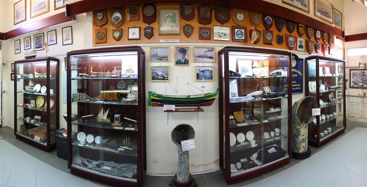 The privately owned Kelinu Grima Maritime Museum, in Nadur, has a myriad of exhibits, among which one can find rare and priceless articles such as authenticated pieces of timber from Lord Nelson's ship "HMS Victory", the "Constitution", which was the first US warship, as well as one of Lord Mountbatten's gold epualettes which he wore during the period of duty in the Meditarrenean.
The hundreds of exhibits in the museum were painstakingly and laboriously collected by Kelinu Grima, a one time primary school teacher, who spent something like 65 years collecting maritime memorabilia. The extent of the collection, which includes models, uniforms, photographs and vessel parts, may be gauged by well over 300 vessel crests that adorn the museum walls.
Dahlet Qorrot Bay
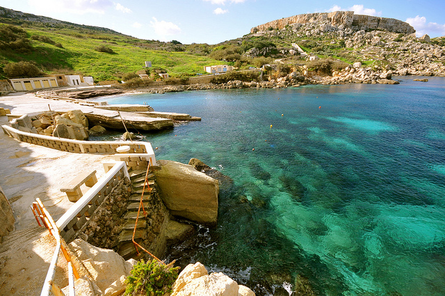 Dahlet Qorrot is a small inlet nestled between the northern cliffs of Gozo not far from in-Nadur. There is a little pebbly beach to swim off, as well as a quayside and rocks on either side of the bay taking you straight into clear deep water.
The cove is used by a small number of fisherman who have turned some caves at the base of the cliffs into boat houses and storage for their fishing gear. The fishermen can often be seen mending their nets or repairing their colourful boats to keep them seaworthy.
San Blas Bay
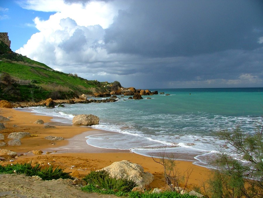 San Blas Bay is a pretty beach of red sand - a little sister to Ramla Bay. It is accessible from the village of in-Nadur via a narrow road the last part of which is closed to traffic because it is exceptionally steep. This discourages many people making San Blas Bay a very peaceful place.
It is naturally peaceful too. Located on the North-East coast of the Island, San Blas Bay lies at the end of one of the most beautiful fertile valleys of Gozo, with no buildings to barr the view.
Mgarr Harbour
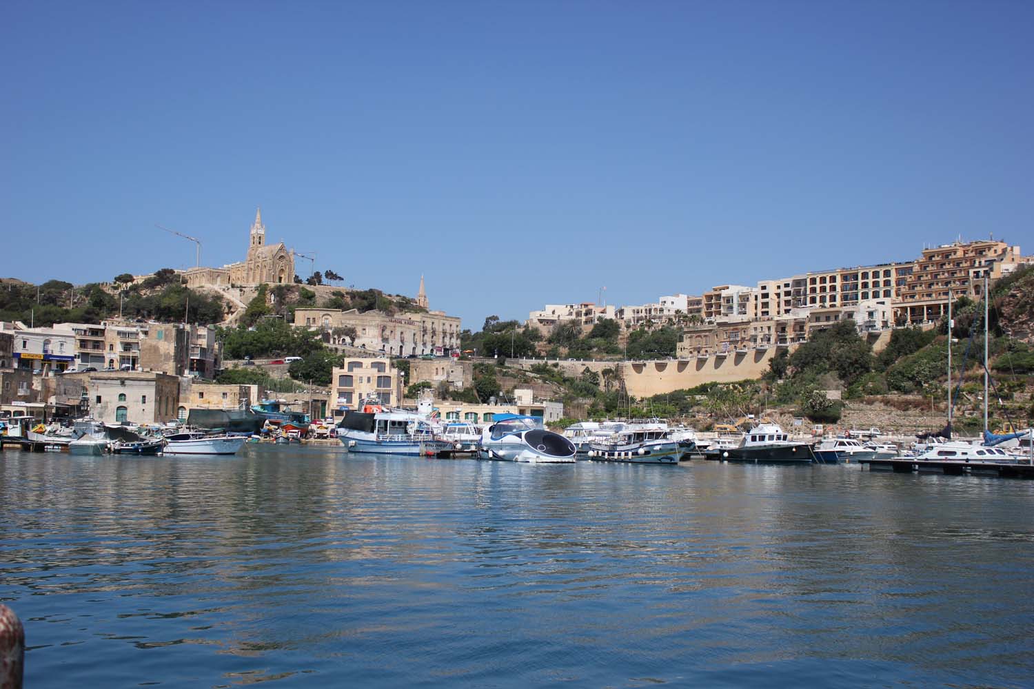 The town of Mgarr grew up around the shallow harbour which shares its name. Ferry services to Malta were in operation by 1241, and fishing was already established. While the area around the harbour was developed over the following centuries, there was little development of the harbour itself until 1841, when a breakwater was constructed to provide more shelter to the port. This breakwater was strengthened and extended several times up to 1906. A larger breakwater was constructed between 1929 and 1935, and two more in 1969; on the completion of the latter, the area of the port was expanded to 121,400 square metres.
The ferry terminal was rebuilt in the early 21st century. The terminal opened in February 2008. The harbour now has facilities for around 600 passengers and 200 cars. The design of the new harbour was changed during the construction process to reduce its visual impact on the surrounding landscape.
Comino
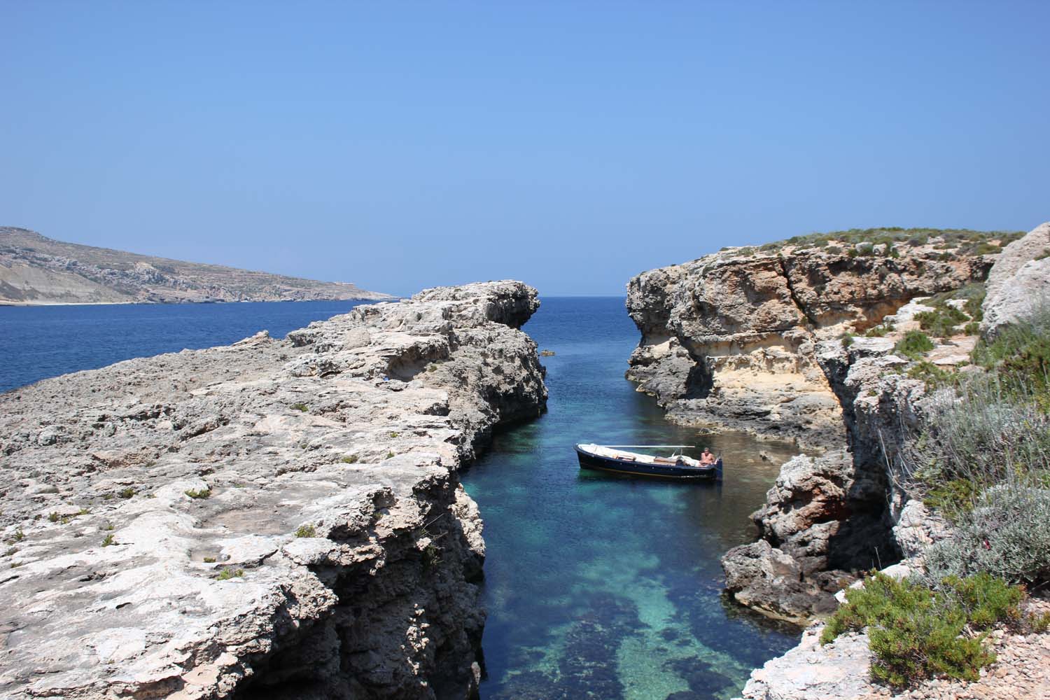 Comino (Maltese: Kemmuna) is an island of the Maltese archipelago between the islands of Malta and Gozo in the Mediterranean Sea, measuring 3.5 square kilometres (1.4 sq mi) in area. Named after the cumin seed that once flourished in the Maltese islands, Comino is noted for its tranquility and isolation.
Comino is known to have been inhabited by farmers during Roman times, but for long periods in its history it has been sparsely populated, privately owned, or abandoned entirely. Its rugged coastline is delineated by sheer limestone cliffs, and dotted with deep caves which were popular with pirates and marauders in the Middle Ages. The caves and coves of Comino were frequently used as staging posts for raids on hapless boats crossing between Malta and Gozo. In later years, the Knights of Malta used this island as hunting and recreational grounds. The Knights were fiercely protective of the local game, which consisted of wild boar and hares: upon conviction, poachers were liable to a penalty of three years as a galley slave. From 1285 until some time after 1290, Comino was the home of exiled prophetic cabbalist Abraham Abulafia. It was on Comino that Abulafia composed his "Sefer ha-Ot" (The Book of the Sign), and his last work, "Imre Shefer" (Words of Beauty).
Comino has a permanent population of only four residents. One priest and one policeman commute from the nearby island of Gozo, to render their services to the local population and summertime visitors. Today, Comino is a bird sanctuary and nature reserve. Administratively it is part of the municipality of Ghajnsielem, in southeastern Gozo. Comino is a popular location for filmmakers. It appears in the movies Troy, The Count Of Monte Cristo and Swept Away.
Blue Lagoon
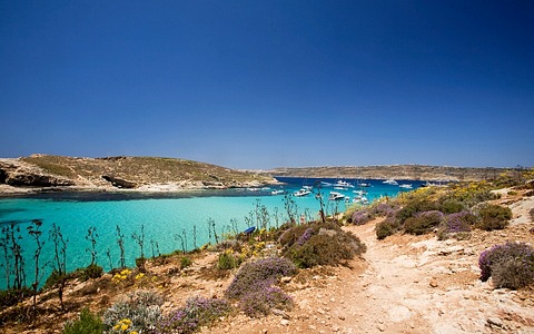 Between Comino and adjacent islet of Cominotto lie the transparent, cyan waters of the Blue Lagoon. Frequented by large numbers of tourists and tour boats daily, the Blue Lagoon is a picturesque bay with a white sandy base and rich marine life. It is popular with divers, snorkelers and swimmers.
Santa Maria Bay
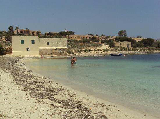 Other beaches on Comino include St. Mary Bay (Maltese: Ramla ta' Santa Marija) and St. Nicholas Bay (Maltese: Bajja San Niklaw).
Santa Maria Tower
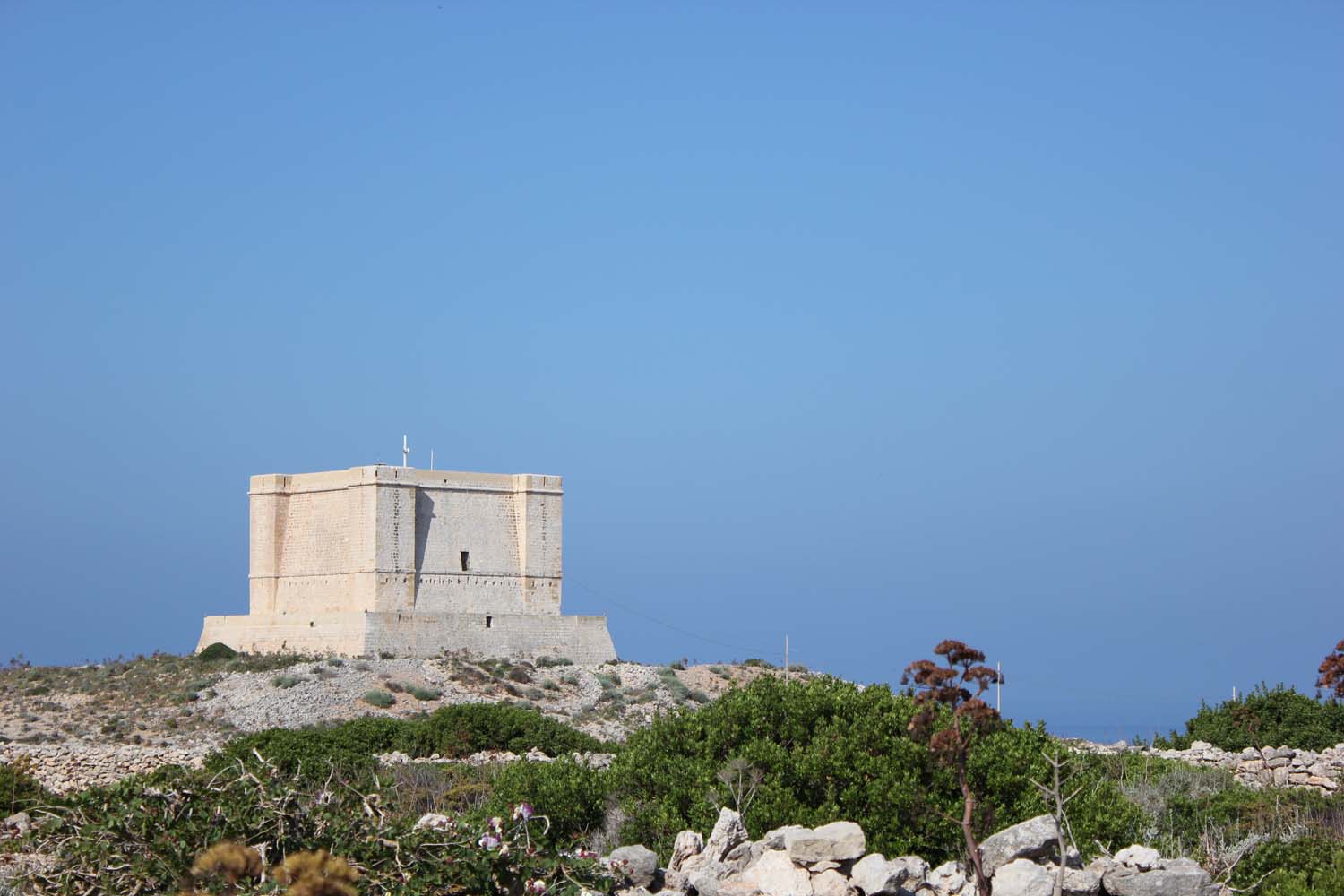 St Mary's Tower is the most visible structure on the island. Its background dates back to 1416, when the Maltese petitioned their king, Alfonso V of Aragon, to build a tower on Comino to serve as an early warning system in case of invasion, and to deter marauding Turks, pirates, smugglers and corsairs from using Comino as a hiding place and staging ground for devastating sorties onto the sister islands of Malta and Gozo. Two years later the king levied a special tax on imported wine to raise funds for this project, but diverted the monies into his coffers; the island remained undefended for another two hundred years.
Finally, in 1618 the Knights of Malta under Grandmaster Wignacourt erected St Mary's Tower, located roughly in the center of the southern coast of the island. The tower formed part of a chain of defensive towers - the Wignacourt, Lascaris, and De Redin towers - located at vantage points along the coastline of the Maltese Islands, and greatly improved communications between Malta and Gozo.
The tower is a large, square building with four corner turrets, located about 80 m (262 ft) above sea level. The Tower itself is about 12 m (39 ft) tall, with walls that are approximately 6 m (20 ft) thick, and is raised on a platform and plinth that are approximately 8 m (26 ft) high. During the French Blockade (1798-1800), St Mary's Tower served as a prison for suspected spies. In 1829 the British Military abandoned the site. For several decades it was deemed to be property of the local civil authorities, and may have been used as an isolation hospital, or even as a wintering pen for farm animals. The tower again saw active service during both World War I and World War II.
St Mary's Tower underwent extensive restoration between 2002 and 2004. Today, it remains the most notable structure on Comino, and provides a destination for tourists taking walks around the Island. It is operated by the Din L-Art Helwa National Trust and is open on Wednesdays, Fridays, Saturdays and Sundays from April to end of October between 10.30am and 3.00pm if the flag is flying.
St. Mary's Tower on Comino was featured in the film The Count of Monte Cristo, where it doubled as the Chateau d'If.
www.dinlarthelwa.org
Santa Maria Gun Battery
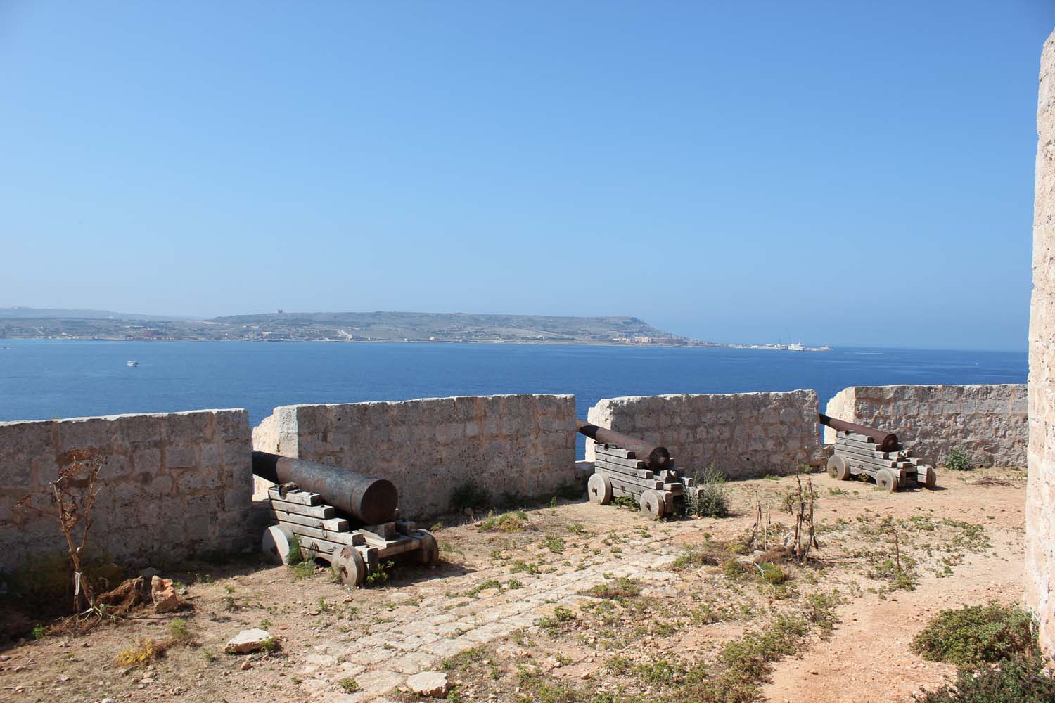 St Mary's Battery, built in 1716, at the same time as various other batteries around the coastline of mainland Malta, is situated facing the South Comino Channel. It is a semi-circular structure with a number of embrasures facing the sea. The Battery still houses two 24-pound iron cannons, and remains in a fair state of preservation mainly due to its remote location. Its armament originally included four 6-pound iron cannons. The Battery underwent restoration in 1996 by the Maltese heritage preservation society, Din l-Art Helwa. St. Mary's Redoubt, an additional defensive structure, was also constructed in 1716 on the northern coast of Comino, however it was subsequently demolished. The Knights also constructed army barracks on Comino. In the early 20th century the barracks were periodically used as an isolation hospital.
Kemmunett
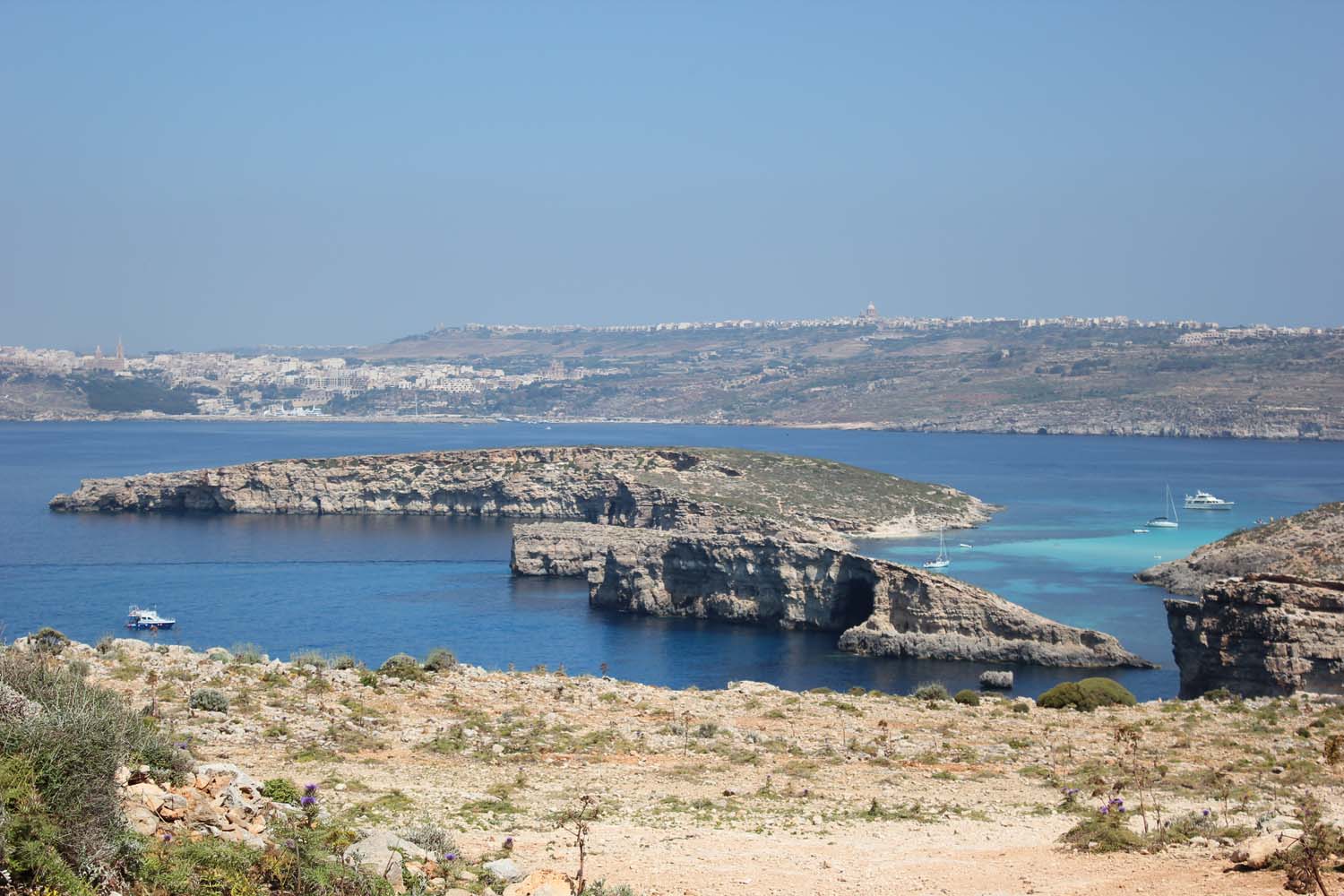 Cominoto (Kemmunett), sometimes referred to as Cominetto, is an uninhabited Mediterranean island of the northern coast of Malta. Measuring only 0.25 square kilometres (0.10 sq mi) in area, Cominoto lies 100 metres (328 feet) to the north west of Comino.
St Anthony's Battery
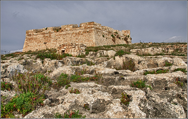 St Anthony's Battery is an early 18th century military outpost designed to serve as a gun battery for the defence of the coast and the channel between Gozo and Comino. It was built during the reign of Grand Master Manoel de Vilhena and was probably designed by the French military engineer Charles Francois Mondion in 1731/2. The Battery retains its original relationship with the surrounding landscape and seascape as these have remained practically unchanged since 1731.
Restoration works on this site have been completed recently.
Hondoq ir-Rummien Bay
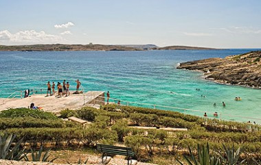 Hondoq ir-Rummien, the coastline below the village of Qala (Gozo, Malta) is dotted with traditional salt pans, some of which are still actively used to harvest salt throughout the summer months. On this coast is a small cove, Hondoq ir-Rummien (which in English means, Pomegranate Moat), which is popular with snorkellers because of its deep and clear water and the small caves at water level. Access to the sea is from bathing ladders. The cove has good views over Comino. There is also a small white sand beach sheltered by a small promontory on the south/west side.
Hondoq ir-Rummien, a beautiful coastal area and bay in Qala Gozo. The sea in this area boasts some of the cleanest, clearest water in all of Malta and Gozo, attracting locals and divers alike. An area of outstanding scenic beauty, it is also a vital habitat for dwindling communities of rare plants.
Taz-Zrieraq
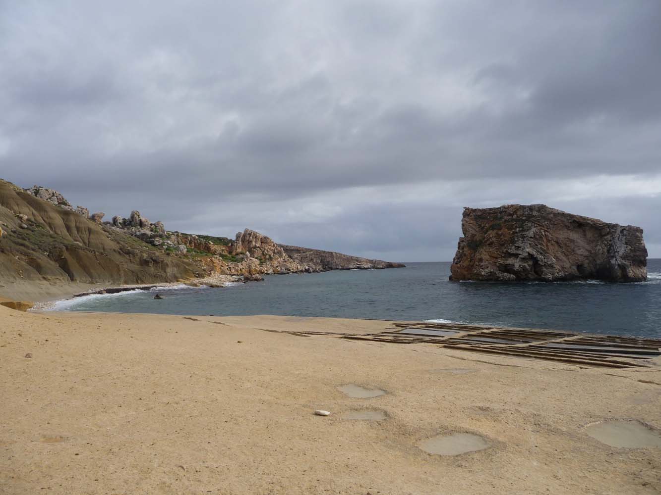 On the road leading to Hondoq ir-Rummien taking a left will lead you to this cove and a beach where you can swim. This area is very secluded but the views are of an outstanding beauty. Along the way down towards the bay, looking towards Comino you should spot the "Elephant", which is a rock formation on the left most side of Comino.
Il-Lunzjata Valley
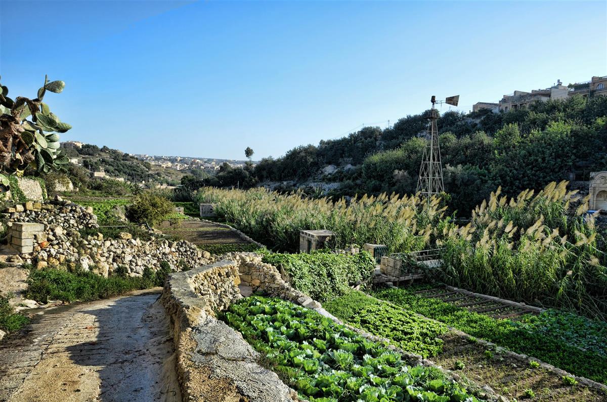 This fertile valley is one of the most picturesque in Gozo with unmatched scenery. It was used by the Knights of Malta for hunting and today it is a very important area for agriculture. It is one of the best places for a relaxing country walk. The continous sound of running water coming from the springs and aquaducts that line the valley adds to the calming ambience. A chapel dedicated to the Annunciation of Our Lady is found at the entrance of Lunzjata.
Santa Lucija Hamlet
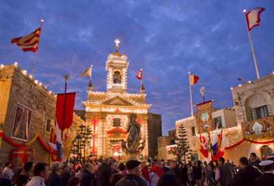 Santa Lucija lies to the west of Victoria, the capital city of Gozo. It is positioned between three hills naimly Ghar Ilma, Il- Mixta and Santa Lucija, each of which bear a natural water spring, making the surroundings one of the most fertile areas of Gozo.
It is generally agreed that the first people to inhabit the Maltese islands were farmers and came over from Sicily more than 5000 BC. The first Neolitic Sicilians might have been encouraged to explore and finally settle down on the little island across the sea visible to the south on very clear cloudless mornings. With them they brought stone tools, domesticated animals, seeds and characteristic pottery. It was this pottery, found at Il-Mixta in Santa Lucija Gozo that in recent research was claimed to be of a purer Sentinello type than that of any Ghar Dalam pottery. This makes the Il-Mixta area the oldest inhabited place in the Maltese Islands.
Very little is known about the early medieval history of the Maltese islands. The next encounter of civilization is a settelment of late medieval houses around the Ghar Ilma plateau, many of which face the south overlooking the village itself.
L-Ghadira ta' San Raflu
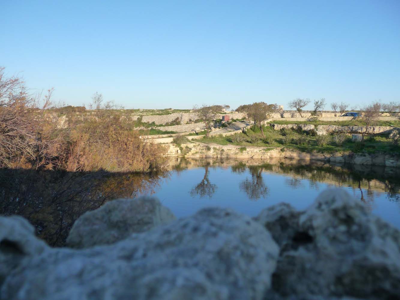 L-Ghadira ta' San Raflu is a man-made pond which is in a very tranquil and splendid area in the outskirts of Kercem. This place is dominated with peaceful serenity and tranquility. L-Ghadira ta' San Raflu is a pond with distinctive characteristics from other ponds located in Gozo and one can notice the numerous turtles, ducks, frogs and goldfish in this pond. In old times, villagers used to come in this pond to wash their clothes. Legend has it that three young ladies who were washing their clothes there were kidnapped by pirates and enslaved on one of their ships.
Wardija Punic Temple
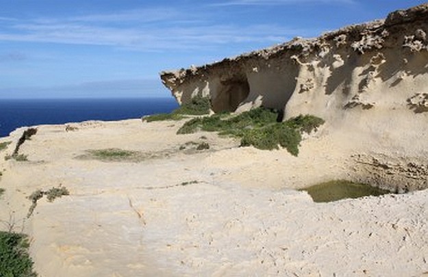 Ras Il-Wardija was investigated by Italian Archaeologists during the years 1964-1967. The excavation points to a Punico-Hellenistic sacred compound with a rock cut sanctuary. Early activity at the site is indicated by the presence of prehistoric cart tracks which might suggest a bronze age settlement, but the earliest pottery found indicated third century BC occupation.
Ghar il-Mixta
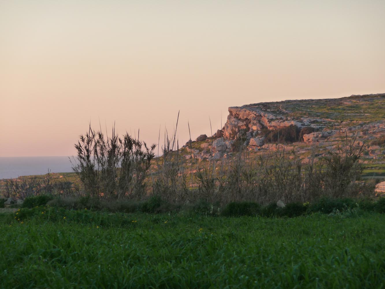 While not a distinguished site in itself, this cave in the cliffs on the west side of the plateau of Ghajn Abdul, one of Gozo's flat-topped hills west of Santa Lucija and overlooking Dwejra, yielded a quantity of very early sherds of the Ghar Dalam phase (c. 5000-4500 BC). Other caves nearby were destroyed by quarrying, though some more early sherds were recovered before they disappeared.
Ta' Gurdan Lighthouse
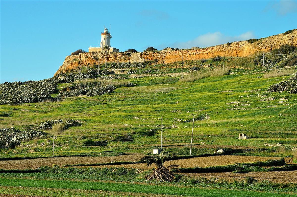 If you'd like to catch a fantastic 360 view of Gozo, then Ta' Gurdan Lighthouse is the place to go to.
The view from up there is especially lovely in winter, when the landscape is green.
This lighthouse rises to approximately 161 metres above sea level.
It overlooks the tiny village of Ghasri and is located in an area called Ta' Gordan Hill.
Constructed in 1851 during the British period, the lighthouse was built to monitor and assist maritime traffic in the region.
In the old days, the lighthouse had several oil lamps on each of its 3 sides.
Centuries later the lighthouse became fully operated without manpower due to modern electromechanical systems and devices.
It is said that at night in the old days, its powerful beam could be seen from practically everywhere on Gozo island.
The hilly walk to the lighthouse is very steep and can leave most breathless but the views from up there are truly worth it. Not to mention the blissful tranquility you will experience there too.
Wied il-Ghasri Valley
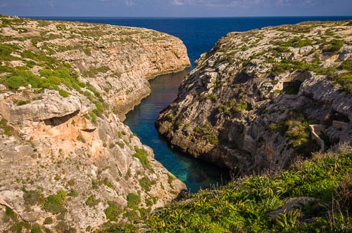 The Wied il-Ghasri area is a marvellous country walk or cycling site especially in Winter and Spring. The valley begins at Ta' Dbiegi Hill before winding down through the village of l-Ghasri, and on between iz-Zebbug and Ta' Gurdan Hill to meet the sea between impressive cliffs. Wied il-Ghasri is very popular with divers who like to explore the surrounding underwater caves. The very narrow and secluded bay is also a haven for those who seek a quiet bathing area.
Where the valley meets the sea is an interesting cave with a shaft dug right up to the top of the steep cliffs above. This used to contain a rig of ropes and buckets to bring up sea water to fill the neighbouring saltpans.
L-Ghajn tal-Hasselin
 In the sixteenth century, in the small village of il-Fontana, arched shelters were built over the springs for the convenience of people when washing their clothes. A very old irrigation system made up from stone gutters constantly brings water from a spring situated in the Ta' Kercem part of the valley.
Xewkija Rotunda Church
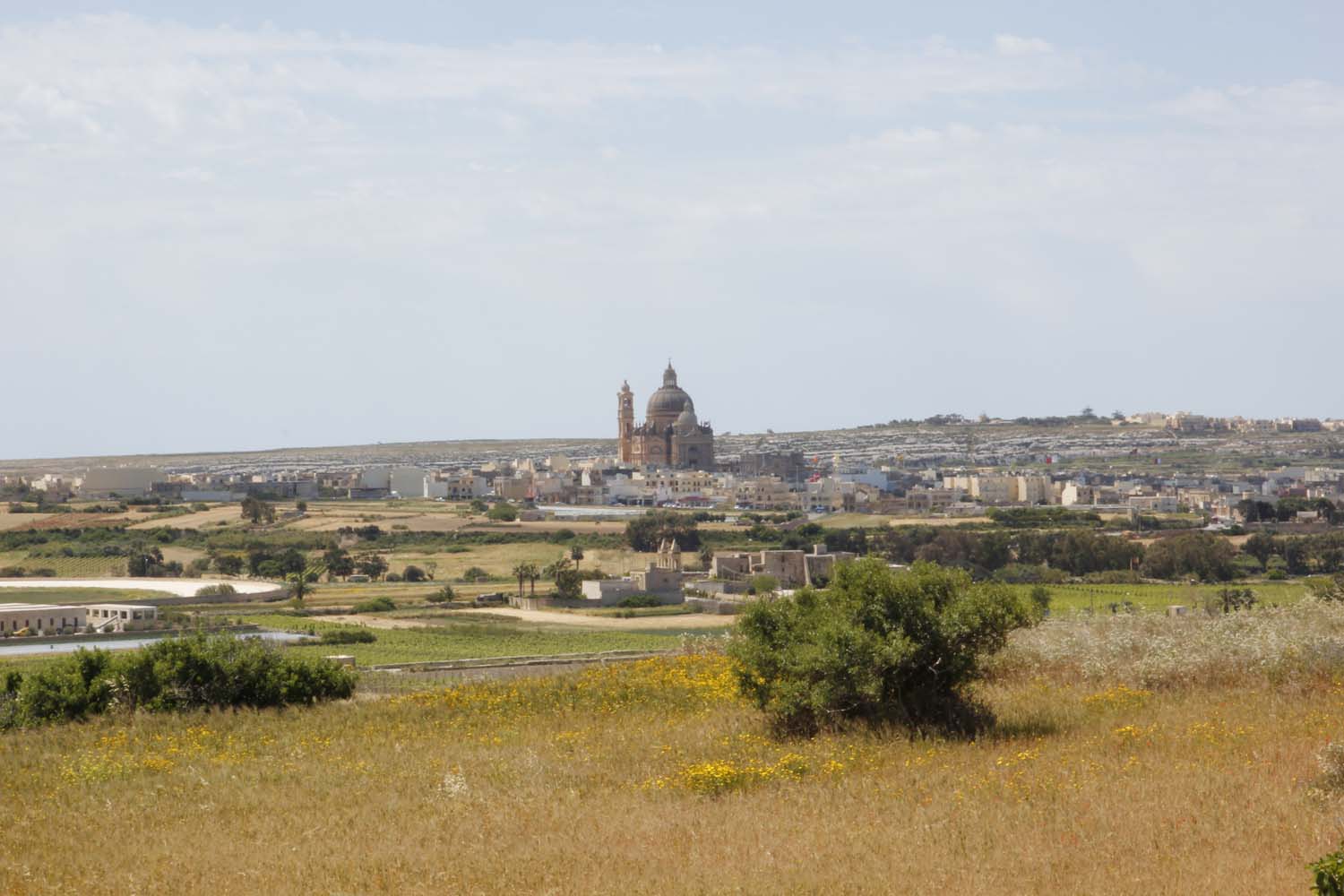 The name is derived from the Maltese word "Xewk", meaning "thistles" or "thorns". Xewkija is famous for its church, The Rotunda, which is dedicated to St. John the Baptist. It is the Seat of the Knights of the Order of St. John, and was built from Maltese stone by local masons and craftsmen. It is the largest in Gozo and its dome dominates the village. Its architect was Joseph D'Amato. It replaced an older church. The titular statue of Saint John the Baptist was sculpted in wood by Pietro Paolo Azzopardi in 1845. The Rotunda, which claims to have the third largest unsupported dome in the world (28m in diameter and 75m tall), was built in the twentieth century and dedicated to St. John the Baptist. In the impressive white limestone interior, eight concrete columns covered with stone support the elegant dome, which has an estimated weight of 45,000 tonnes. The interior shows off the versatility and
texture of local limestone and the skills of local craftsmen. It is sparsely decorated with fine sculptures and modern paintings. The floor is of polished Carrara marble and the main altar is also carved in precious marble.
On the site where the present church is, it was said that there was a stone known as 'Maqghad ix-Xih'. Near it there is a small ancient chapel known as Madonna tal-Hniena (Our Lady of Charity) which was dedicated to San Bartilimew. The tower of Santa Cecilja had been in the limits of Xewkija. There is another tower with the oldest sundial in Xewkija. Remains of Tinghi Tower disappeared in the last century. These towers date back to 1613. A 14th century tower used by the Grandmasters as a summer residence, the Tower of Gorgion, was demolished during the Second World War to make way for a temporary airport. A marble slab of Majmuna with an Arabic inscription dating back to 1173 was found in Xewkija. It commemorates the death of an Arab girl named Sarah, who died in Xewkija. The inscription is carved in a thick marble slab, on the underside of which there is a pagan symbol. Brother Gabrijel D'Alappo translated it into Italian and it was later translated into Maltese. It was sent to the Public Library in Malta in 1845 and brought to the Gozo National Museum in 1960.
Mgarr ix-Xini Cove
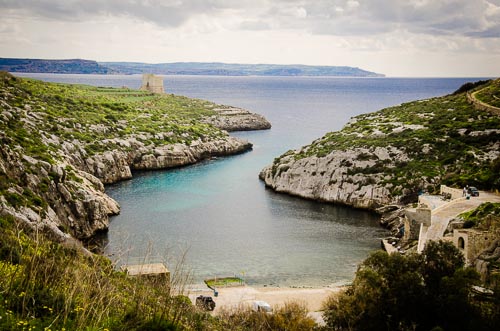 On the coast beyond the village lies the beautiful unspoilt Mgarr ix-Xini Valley and access to the peaceful Bay of Mgarr ix-Xini which is a lovely place to swim, snorkel and dive. Ix-Xewkija is an ideal base for walking as well as abseiling in winter and spring. Also close to the village are a variety of important modern Gozo institutions including the University of Malta (Gozo Campus), the Gozo Football Stadium and the island's Industrial Estate.
Mgarr ix-Xini Tower
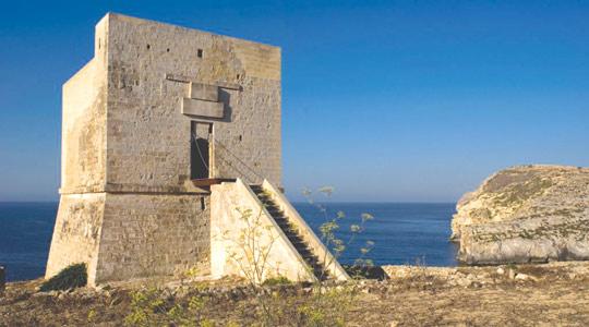 On the rocks at the entrance to the delightful narrow bay of Mgarr Ix-Xini is this historic Knights-period coastal defence tower. Built in the mid-seventeenth century, it arrived too late to prevent the Ottoman Turks from using this inlet in the devastating attack of 1551 when most of the population of Gozo was taken into slavery, many loaded onto ships just below where the Mgarr ix-Xini tower stands today.
Mgarr ix-Xini tower is one of 14 coastal towers built around the coasts of Malta and Gozo during the reign of Grand Master de Redin in 1658-59. It has a square plan and contains two floors, each with vaulted ceilings, and a flat roof with a shallow parapet. Unlike the other De Redin towers the Mgarr ix-Xini tower had only one entrance, approached by a flight of steps and a palisade drawbridge. A spiral staircase climbs in the thickness of the north wall up to the roof.
The towers could all communicate with neighbouring towers - usually through fires on their roofs. The Mgarr ix-Xini tower's neighbours were the St Cecilia Tower (also on Gozo) and the Comino tower on the neighbouring island of the same name (between Malta and Gozo). Look out from the Mgarr ix-Xini tower today and you can still see the Comino Tower.
The Mgarr ix-Xini tower was built by the Universita (local government) of Gozo to a plan by Mederico Blondel, an engineer of the Order of St John, at an estimated cost of 857 Scudi (equivalent to Euro 166). The tower was functioning by June 1661 and was manned by a castellan and a professional bombardier. By 1785 when the Ottoman threat had receded, the tower was probably not permanently manned as it does not appear in the artillery survey of that year. However during an alert in 1792, the Knights Congregation of War is recorded ordering that the tower be armed with two 6 pounder iron guns.
The Mgarr ix-Xini Tower was jointly restored during the year 2000 by the Ministry for Gozo and Wirt Ghawdex (Gozo Heritage). An old cobbled path leading to the tower from Mgarr ix-Xini bay (and all the way from ix-Xewkija), has been cleared and reopened, creating a very pleasant walk to the tower.
Ta Blankas Olive Grove
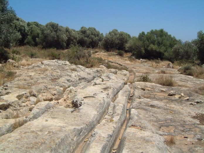 This olive yard is situated in the area known as Ta' Blankas and known as the 'Gnien Ta' Blankas'.
Fort Chambray
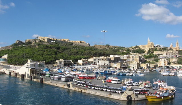 Fort Chambray was a fort situated in the precincts of Ghajnsielem, on the island of Gozo, Malta. This fortress was built in the area of Ras it-Tafal which is situated between the port of Mgarr and that of Xatt l-Ahmar. It is named after Bailiff Jacques Francois de Chambray, who was Governor of Gozo from 1749 to his death in 1756.
In its 250-year life, the fort experienced only one brief military adventure. In 1798, it was Gozo's defence against the revolutionary forces of Napoleon. During the remaining years of the Knights' rule in Malta, the fortress never experienced any attack mainly due to the decline of the Berber and Turkish marauders. During the first four decades of British rule, the Fort's importance diminished. It was in fact abandoned for several years but found a new lease of life when several British regiments were stationed there during the Crimean War and the First World War.
Most of the fortress, except for its outer bastions and the Knights barrack, was destroyed in the 1990s in order to make way for a small village. The project was later abandoned but restarted recently with the intention of creating an upscale residential development.
Santa Cecilia Medieval Chapel
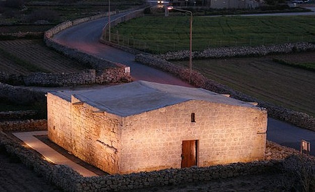 Probably built in around 1540 and certainly documented from 1615, this is the oldest surviving chapel in Gozo. Dedicated to St Cecilia, patroness of sacred music (whose feast day is November 22), it was completely restored prior to 1630 and functioned intermittently as a church until 1644 when it was declared unfit for the celebration of mass and deconsecrated.
This small stone church is the best example of the many unaisled chapels that once dotted the countryside of Gozo. Like other late medieval chapels it is a plain cube except for the slight pitch of the roof. Its floor measures seven by seven metres, nearly a perfect square. It is divided into four bays by three slightly pointed arches rising from wall piers to hold up the shallow pitched stone roof. At the entrance, three steps lead down to the chapel floor which is about a metre below ground level. The only light source inside is a single rectangular window over the door.
In 1613, the neighbouring tower was built; affording a degree of protection to the farming community of the area but the socio-economic conditions and ecclesiastical policy of the period signaled the beginning of the end for the chapel - despite considerable local support for it to stay open.
After periods of closure in 1630 and 1634, in 1635, a devotee, Pasquale Muscat, is recorded as having given the sum of six tari per year for the maintenance of the church. This payment, however, seems to have ended with his death, which is registered in 1644, shortly before the final deconsecration of the chapel. A few years later ix-Xewkija became the first rural parish of Gozo and the building of the parish church of St. John the Baptist meant that the centre of religious activity shifted east. The abandoned church became an ancillary building to the St Cecilia tower and may even have been used to house a mule-powered mill. The tower and church were listed as Grade One monuments in 1996 but little was done to protect the chapel which was battered by weather and vandalism until it was finally entrusted to Wirt Ghawdex (Gozo Heritage) in 2008. It has now been fully restored and is open to visitors as well as hosting lectures, exhibitions, concerts and even business conferences.
www.wirtghawdex.org
Ix-Xatt l-Ahmar
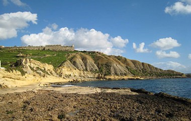 Ix-Xatt l-Ahmar (on the Mgarr - Rabat road, to the left just after reaching Ghajnsielem) is another secluded bay with ample space for diving. The wreck of the "Xlendi", a ferry boat that until recently plied between Malta and Gozo lies in the depths of this location, thus enhancing the attractions of this excellent dive-site. Swimming is possible off white rocks, but ladders make getting in and out of the water easy. From this spot lovely view of the west coast of Malta can be seen.
Tal-Qighan - Borg il-Gharib
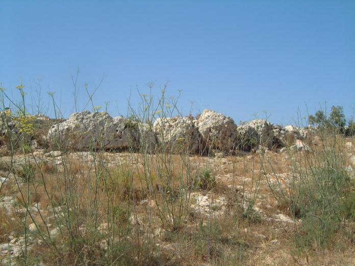 These ruinous remains of a temple consist of 2 groups of megaliths standing on a low plateau north of the village of Ghajnsielem.
The larger group stands on the south-east corner of the plateau and consists of slabs up to 3 metres high by 2 metres wide. The western group of smaller stones lines the edge of the plateau where it falls away steeply on the north and north-west sides.
Xlendi Bay
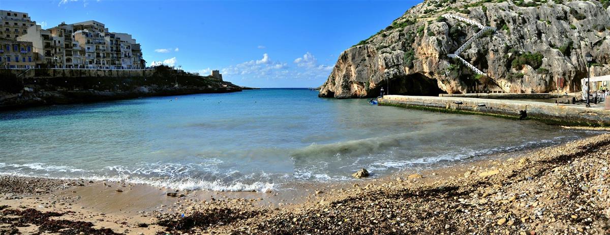 Xlendi Bay is three kilometres away from Victoria on the southwest side of Gozo. This beautiful inlet with a sandy beach ideal as a swimming spot for both young and old. For many years this bay used to be a fishing village, but recently it has been transformed into a tourist attraction. As a tourist resort it is equipped with several tourist-oriented amenities, such as, bars, restaurants, holiday flats and hotels.
For the annual festivities at this church hundreds of local people and foreigners visit this place, where one can see the traditional and characteristic gostra (greasy pole). A large pole well covered with grease fixed to the rocks from one side and jutting out over seawater at 20 degree angle. At its extreme end a small flag is fixed. Swimmers climbing this pole try to snatch this flag in order to get the prize. Xlendi Bay is entirely clean and safe for swimming, snorkeling, diving and is also a place for artist. It is a place where restaurants specialize in local food, especially fresh fish dishes; one can also find foreign food.
Xlendi Tower
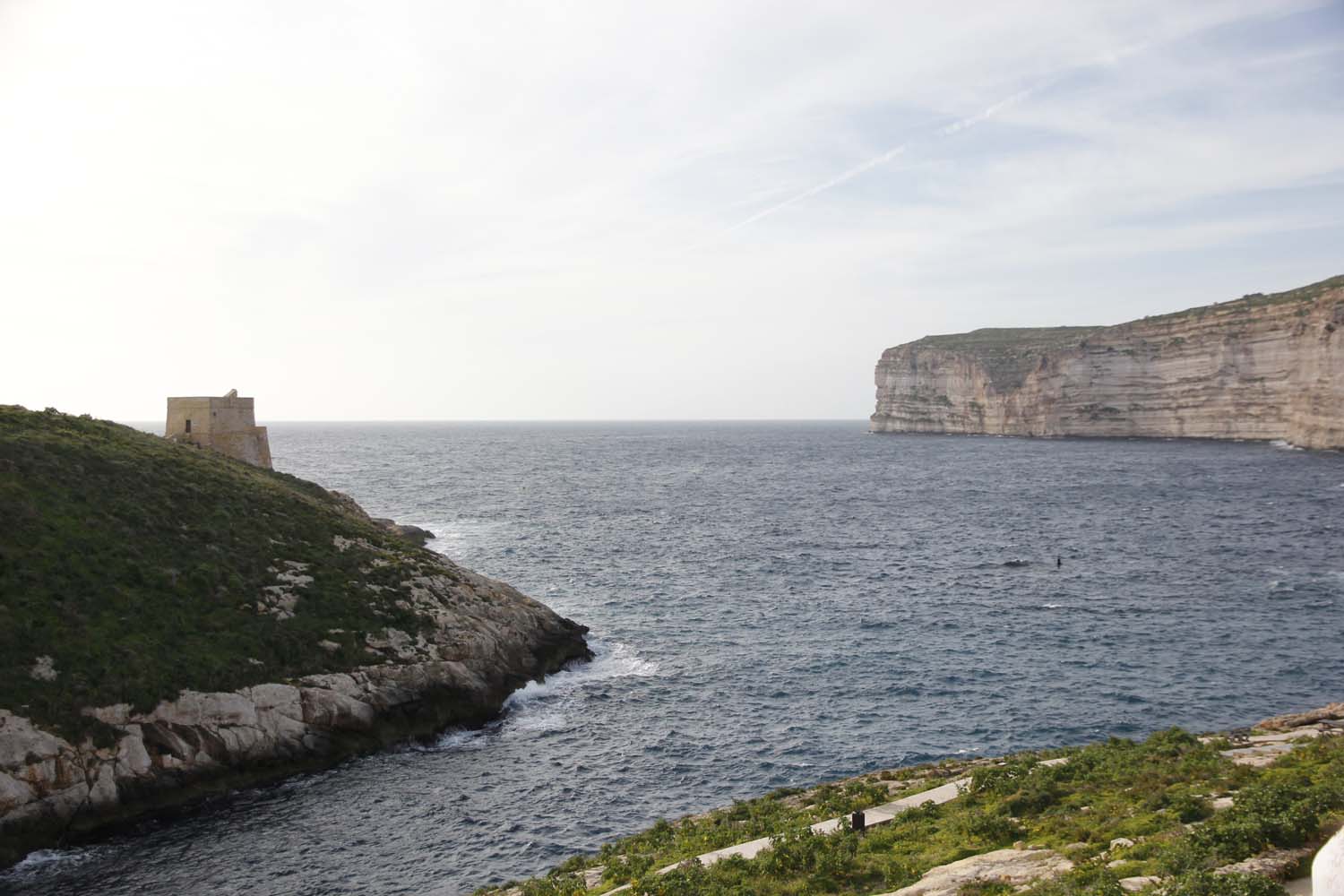 The Xlendi Tower was built in 1650 and since the two towers preceding it do
not exist today, this makes this tower the oldest one in Gozo. This is true
if we are not to consider the Comino Tower which was built in 1618. The
Xlendi Tower was first projected by Baliff Baldassare de Demandolx in 1649
and after slightly more than a year it was already completed. It was paid
for by the Universita of Gozo and the Grand Master of the time, Lascaris,
ordered that 2 iron guns be mounted. The Capo Mastro, or commander of the
tower, was paid by the Order and the Universita. The Capo Mastro was a
bombardier and he manned the tower with an assistant or Aggiutante. It is 10
metres square and it has a unique shape as its seaward side has its lower
part protruding out. It was also manned by three guards. In 1681, only 31
years after it was constructed, it was described to be in a bad state and
needed restoration. As with other coastal towers, under British rule the
Xlendi tower was manned by the Royal Malta Fancible Regiment which changed
its name in 1861 to the Royal Malta Fancible Artillery. In 1873 the latter
gave up its coastal guard commitments and so it was abandoned. During the
second World War the tower was used as a Coast Observation Post and was
manned by the Coast Police.
With the advent of the aeroplane and modern warfare, the fortifications
around our islands became useless. The Xlendi tower also lost its military
role and private persons started showing interest to use them. In 1954 the
tower was leased to private persons but was eventually abandoned to its
fate.
The tower is now being restored as a joint venture between Din l-Art Helwa and the Munxar Local Council, expenses on a 50/50 basis. Medserv is sponsoring Din l-Art Helwa's share of the expenses.
Ta Cenc Garrigue
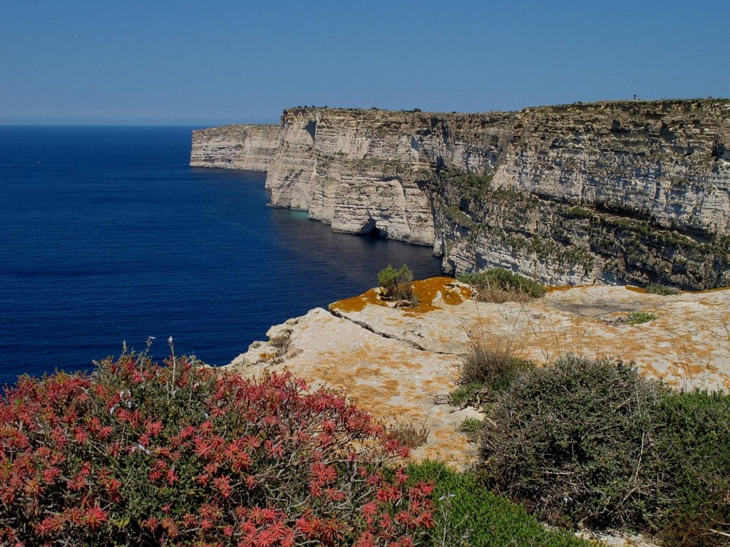 Ta' Cenc is situated near the village of Sannat. The habitat consists of garrigue and cliffs. The area is rich in biodiversity especially in breeding sea birds. The area is also a bird sanctuary. It is privately owned but the owner lets people of the public to birdwatch and enjoy a walk. The area is a beautiful place to experience and one can view wonderful landscapes.
Sanap Cliffs
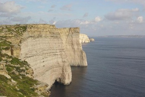 The Sanap Cliffs trail starts in Munxar and continues on over the cliffs. Here you can see layered sections of grass and crops all separated by cobbled walls. On one side there are beautiful white, vertical drop cliffs and an uninterrupted expanse of steely grey sea.
